Puquio geodata
Puquio (Ayacucho) is a seat of a third-order administrative division; located in Peru in America/Lima (GMT-5) time zone. With population of 10,491 people, there are 139 cities with bigger population in this country. Compared to other cities in Peru, 83.7% of cities are located further ↑North; 65.1% of cities are located further ←West and 61.8% of cities have lower elevation than Puquio. Note1


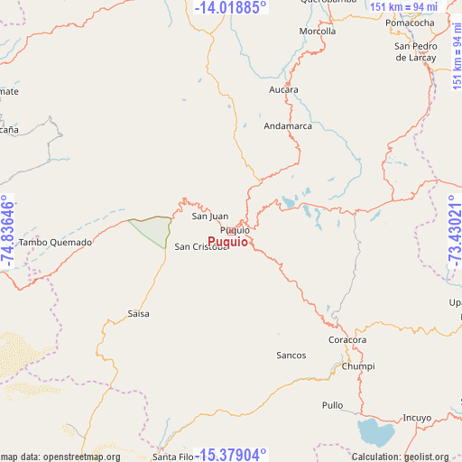
Puquio GPS coordinates[2]
14° 42' 0" South, 74° 7' 59.988" West
| Map corner | latitude | longitude |
|---|---|---|
| Upper-left | -14.01885°, | -74.83646° |
| Center: | -14.7°, | -74.13333° |
| Lower-right: | -15.37904°, | -73.43021° |
| Map W x H: | 151.2×151.2 km | = 94×94mi |
| max Lat: | -0.96667° ⇑83.7% North |
| Puquio: | -14.7° |
| min Lat: | ⇓16.3% South -18.01465° |
| min Long | Puquio | max Long |
| -81.30472° | -74.13333° | -69.04167° |
| W 65.1%⇐ | ⇒34.9% E |
Elevation
Elevation of Puquio is 3195 m = 10482 ft, and this is 876.3 m = 2875 ft above average elevation for this country.
| Max E: |
5022 m = 16476 ft | 38.2% |
| Puquio | 3195 m 10482 ft | |
| Avg. | 2318.7 m = 7607 ft | |
Min E: |
1 m = 3 ft | 61.8% |
See also: Peru elevation on elevation.city.
Geographical zone
Puquio is located in South Torrid zone (between Equator and Tropic of Capricorn). Distance of this Southern Tropic circle is 971.4 km =603.6 mi to South.| Distance of | km | miles | from Puquio |
|---|---|---|---|
| Equator | 1634.5 | 1015.6 | to North |
| Tropic Capricorn | 971.4 | 603.6 | to South |
| Antarctic Circle | 5766.7 | 3583.3 | to South |
| South Pole | 8372.6 | 5202.5 | to South |


Nearby cities:
15 places around Puquio: (largest is in red/bold)
• Andamarca
39.4 km =24.5 mi,  28°
28°
• Aucara
49.6 km =30.8 mi,  19°
19°
• Cabana
48.9 km =30.4 mi, 21°
• Chaviña
45.1 km =28 mi,  134°
134°
• Chipao
46.3 km =28.8 mi,  36°
36°
• Chumpi
59.4 km =36.9 mi,  138°
138°
• Coracora
52.8 km =32.8 mi, 134°
• Huacaña
64.3 km =40 mi, 24°
• Lucanas
16.8 km =10.4 mi,  311°
311°
• Otoca
65.6 km =40.8 mi,  291°
291°
• Pullo
66.8 km =41.5 mi,  149°
149°
• San Juan
9.1 km =5.7 mi, 307°
• San Pedro
8.2 km =5.1 mi, 154°
• Tambo
25 km =15.5 mi,  115°
115°
• Tambo Quemado
59.3 km =36.8 mi,  266°
266°
Sources, notices
• [Note1] Compared only with cities in Peru existing in our database
• [Src1] Map data: © OpenStreetMap contributors (CC-BY-SA)
• [Src2] Other city data from geonames.org with taken over terms of usage.
• [Src3] Geographical zone / Annual Mean Temperature by Robert A. Rohde @ Wikipedia
