San Mateo geodata
San Mateo (Lima region) is a seat of a third-order administrative division; located in Peru in America/Lima (GMT-5) time zone. In our database, there are 305 cities with bigger population. Compared to other cities in Peru, 50.3% of cities are located further ↓South; 56.7% of cities are located further →East and 60.1% of cities have lower elevation than San Mateo. Note1
Administrative division(s):
- Level 1: Lima region
- Level 2: Provincia de Huarochirí
- Level 3: San Mateo


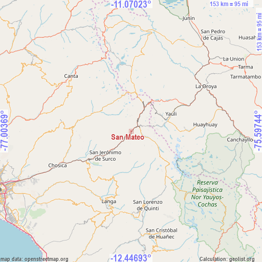
San Mateo GPS coordinates[2]
11° 45' 33.984" South, 76° 18' 2.016" West
| Map corner | latitude | longitude |
|---|---|---|
| Upper-left | -11.07023°, | -77.00369° |
| Center: | -11.75944°, | -76.30056° |
| Lower-right: | -12.44693°, | -75.59744° |
| Map W x H: | 153.1×153.1 km | = 95.1×95.1mi |
| max Lat: | -0.96667° ⇑49.7% North |
| San Mateo: | -11.75944° |
| min Lat: | ⇓50.3% South -18.01465° |
| min Long | San Mateo | max Long |
| -81.30472° | -76.30056° | -69.04167° |
| W 43.3%⇐ | ⇒56.7% E |
Elevation
Elevation of San Mateo is 3159 m = 10364 ft, and this is 840.3 m = 2757 ft above average elevation for this country.
| Max E: |
5022 m = 16476 ft | 39.9% |
| San Mateo | 3159 m 10364 ft | |
| Avg. | 2318.7 m = 7607 ft | |
Min E: |
1 m = 3 ft | 60.1% |
See also: Peru elevation on elevation.city.
Geographical zone
San Mateo is located in South Torrid zone (between Equator and Tropic of Capricorn). Distance of this Southern Tropic circle is 1298.4 km =806.8 mi to South.| Distance of | km | miles | from San Mateo |
|---|---|---|---|
| Equator | 1307.5 | 812.4 | to North |
| Tropic Capricorn | 1298.4 | 806.8 | to South |
| Antarctic Circle | 6093.6 | 3786.4 | to South |
| South Pole | 8699.5 | 5405.6 | to South |


Nearby cities:
15 places around San Mateo: (largest is in red/bold)
• Callahuanca
35.2 km =21.9 mi,  257°
257°
• Carampoma
25.7 km =16 mi,  295°
295°
• Chicla
6.9 km =4.3 mi,  30°
30°
• Cocachacra
31 km =19.3 mi,  236°
236°
• Huanza
24.9 km =15.5 mi, 297°
• Lachaqui
42 km =26.1 mi, 303°
• Lahuaytambo
39.4 km =24.5 mi,  195°
195°
• Laraos
28.1 km =17.5 mi,  292°
292°
• Marcapomacocha
39.4 km =24.5 mi,  354°
354°
• Matucana
14.8 km =9.2 mi,  227°
227°
• Morococha
24.8 km =15.4 mi,  44°
44°
• Santa Eulalia
42.5 km =26.4 mi,  248°
248°
• Suitucancha
39.8 km =24.7 mi,  94°
94°
• Surco
20.6 km =12.8 mi, 227°
• Yauli
25.6 km =15.9 mi,  65°
65°
Sources, notices
• [Note1] Compared only with cities in Peru existing in our database
• [Src1] Map data: © OpenStreetMap contributors (CC-BY-SA)
• [Src2] Other city data from geonames.org with taken over terms of usage.
• [Src3] Geographical zone / Annual Mean Temperature by Robert A. Rohde @ Wikipedia
