Ocoña geodata
Ocoña (Arequipa) is a seat of a third-order administrative division; located in Peru in America/Lima (GMT-5) time zone. In our database, there are 305 cities with bigger population. Compared to other cities in Peru, 95.3% of cities are located further ↑North; 72.8% of cities are located further ←West and 98.8% of cities have higher elevation than Ocoña. Note1


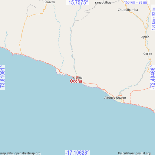
Ocoña GPS coordinates[2]
16° 25' 59.016" South, 73° 6' 28.008" West
| Map corner | latitude | longitude |
|---|---|---|
| Upper-left | -15.7575°, | -73.81091° |
| Center: | -16.43306°, | -73.10778° |
| Lower-right: | -17.10628°, | -72.40466° |
| Map W x H: | 150×150 km | = 93.2×93.2mi |
| max Lat: | -0.96667° ⇑95.3% North |
| Ocoña: | -16.43306° |
| min Lat: | ⇓4.7% South -18.01465° |
| min Long | Ocoña | max Long |
| -81.30472° | -73.10778° | -69.04167° |
| W 72.8%⇐ | ⇒27.2% E |
Elevation
Elevation of Ocoña is 11 m = 36 ft, and this is 2307.7 m = 7571 ft below average elevation for this country.
| Max E: |
5022 m = 16476 ft | 98.8% |
| Avg. | 2318.7 m = 7607 ft | |
| Ocoña | 11 m = 36 ft | |
Min E: |
1 m = 3 ft | 1.2% |
See also: Peru elevation on elevation.city.
Geographical zone
Ocoña is located in South Torrid zone (between Equator and Tropic of Capricorn). Distance of this Southern Tropic circle is 778.7 km =483.9 mi to South.| Distance of | km | miles | from Ocoña |
|---|---|---|---|
| Equator | 1827.2 | 1135.4 | to North |
| Tropic Capricorn | 778.7 | 483.9 | to South |
| Antarctic Circle | 5574 | 3463.5 | to South |
| South Pole | 8179.9 | 5082.8 | to South |


Nearby cities:
15 places around Ocoña: (largest is in red/bold)
• Andaray
75.5 km =46.9 mi,  20°
20°
• Aplao
76.6 km =47.6 mi,  58°
58°
• Atico
60.3 km =37.5 mi,  294°
294°
• Camaná
47.4 km =29.5 mi,  116°
116°
• Chuquibamba
82 km =51 mi,  36°
36°
• Corire
71.8 km =44.6 mi,  71°
71°
• El Cardo
44.8 km =27.8 mi,  114°
114°
• Huancarqui
77.5 km =48.2 mi, 61°
• Iquipi
54.8 km =34.1 mi,  357°
357°
• Iray
82.2 km =51.1 mi, 38°
• La Pampa
48.2 km =30 mi, 114°
• Pampacolca
98.3 km =61.1 mi, 35°
• Quilca
78.2 km =48.6 mi, 113°
• Urasqui
45.5 km =28.3 mi,  351°
351°
• Yanaquihua
77.3 km =48 mi, 18°
Sources, notices
• [Note1] Compared only with cities in Peru existing in our database
• [Src1] Map data: © OpenStreetMap contributors (CC-BY-SA)
• [Src2] Other city data from geonames.org with taken over terms of usage.
• [Src3] Geographical zone / Annual Mean Temperature by Robert A. Rohde @ Wikipedia
