Huancarqui geodata
Huancarqui (Arequipa) is a seat of a third-order administrative division; located in Peru in America/Lima (GMT-5) time zone. In our database, there are 305 cities with bigger population. Compared to other cities in Peru, 93.9% of cities are located further ↑North; 77.7% of cities are located further ←West and 76.6% of cities have higher elevation than Huancarqui. Note1


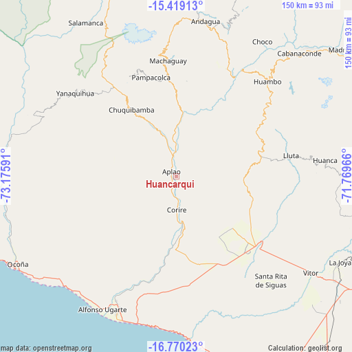
Huancarqui GPS coordinates[2]
16° 5' 44.988" South, 72° 28' 22.008" West
| Map corner | latitude | longitude |
|---|---|---|
| Upper-left | -15.41913°, | -73.17591° |
| Center: | -16.09583°, | -72.47278° |
| Lower-right: | -16.77023°, | -71.76966° |
| Map W x H: | 150.2×150.2 km | = 93.3×93.3mi |
| max Lat: | -0.96667° ⇑93.9% North |
| Huancarqui: | -16.09583° |
| min Lat: | ⇓6.1% South -18.01465° |
| min Long | Huancarqui | max Long |
| -81.30472° | -72.47278° | -69.04167° |
| W 77.7%⇐ | ⇒22.3% E |
Elevation
Elevation of Huancarqui is 603 m = 1978 ft, and this is 1715.7 m = 5629 ft below average elevation for this country.
| Max E: |
5022 m = 16476 ft | 76.6% |
| Avg. | 2318.7 m = 7607 ft | |
| Huancarqui | 603 m = 1978 ft | |
Min E: |
1 m = 3 ft | 23.4% |
See also: Peru elevation on elevation.city.
Geographical zone
Huancarqui is located in South Torrid zone (between Equator and Tropic of Capricorn). Distance of this Southern Tropic circle is 816.2 km =507.2 mi to South.| Distance of | km | miles | from Huancarqui |
|---|---|---|---|
| Equator | 1789.7 | 1112.1 | to North |
| Tropic Capricorn | 816.2 | 507.2 | to South |
| Antarctic Circle | 5611.5 | 3486.8 | to South |
| South Pole | 8217.4 | 5106.1 | to South |


Nearby cities:
15 places around Huancarqui: (largest is in red/bold)
• Andaray
53.2 km =33.1 mi,  308°
308°
• Aplao
3.2 km =2 mi, 314°
• Ayo
50.7 km =31.5 mi,  24°
24°
• Camaná
63.9 km =39.7 mi,  203°
203°
• Chuquibamba
34.6 km =21.5 mi,  326°
326°
• Corire
14.2 km =8.8 mi,  179°
179°
• El Cardo
62.6 km =38.9 mi,  205°
205°
• Huambo
56.3 km =35 mi,  43°
43°
• Iray
31.2 km =19.4 mi, 328°
• La Pampa
62.3 km =38.7 mi, 202°
• Lluta
49.8 km =30.9 mi,  79°
79°
• Pampacolca
43.9 km =27.3 mi,  345°
345°
• Uñon
41 km =25.5 mi,  6°
6°
• Viraco
49.1 km =30.5 mi, 353°
• Yanaquihua
56.1 km =34.9 mi, 309°
Sources, notices
• [Note1] Compared only with cities in Peru existing in our database
• [Src1] Map data: © OpenStreetMap contributors (CC-BY-SA)
• [Src2] Other city data from geonames.org with taken over terms of usage.
• [Src3] Geographical zone / Annual Mean Temperature by Robert A. Rohde @ Wikipedia
