Huayacundo Arma geodata
Huayacundo Arma (Huancavelica) is a seat of a third-order administrative division; located in Peru in America/Lima (GMT-5) time zone. In our database, there are 305 cities with bigger population. Compared to other cities in Peru, 67.3% of cities are located further ↑North; 55.2% of cities are located further ←West and 72.6% of cities have lower elevation than Huayacundo Arma. Note1


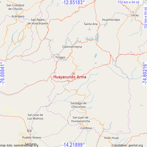
Huayacundo Arma GPS coordinates[2]
13° 32' 11.004" South, 75° 18' 19.008" West
| Map corner | latitude | longitude |
|---|---|---|
| Upper-left | -12.85183°, | -76.00841° |
| Center: | -13.53639°, | -75.30528° |
| Lower-right: | -14.21899°, | -74.60216° |
| Map W x H: | 152×152 km | = 94.4×94.4mi |
| max Lat: | -0.96667° ⇑67.3% North |
| Huayacundo Arma: | -13.53639° |
| min Lat: | ⇓32.7% South -18.01465° |
| min Long | Huayacundo Arma | max Long |
| -81.30472° | -75.30528° | -69.04167° |
| W 55.2%⇐ | ⇒44.8% E |
Elevation
Elevation of Huayacundo Arma is 3389 m = 11119 ft, and this is 1070.3 m = 3511 ft above average elevation for this country.
| Max E: |
5022 m = 16476 ft | 27.4% |
| Huayacundo Arma | 3389 m 11119 ft | |
| Avg. | 2318.7 m = 7607 ft | |
Min E: |
1 m = 3 ft | 72.6% |
See also: Peru elevation on elevation.city.
Geographical zone
Huayacundo Arma is located in South Torrid zone (between Equator and Tropic of Capricorn). Distance of this Southern Tropic circle is 1100.8 km =684 mi to South.| Distance of | km | miles | from Huayacundo Arma |
|---|---|---|---|
| Equator | 1505.1 | 935.2 | to North |
| Tropic Capricorn | 1100.8 | 684 | to South |
| Antarctic Circle | 5896.1 | 3663.7 | to South |
| South Pole | 8502 | 5282.9 | to South |


Nearby cities:
15 places around Huayacundo Arma: (largest is in red/bold)
• Arma
52.8 km =32.8 mi,  332°
332°
• Castrovirreyna
30 km =18.6 mi,  357°
357°
• Chupamarca
64.4 km =40 mi, 330°
• Cocas
30.7 km =19.1 mi,  347°
347°
• Huachos
43.8 km =27.2 mi, 328°
• Huamatambo
62.1 km =38.6 mi,  318°
318°
• Huancano
34.4 km =21.4 mi,  258°
258°
• Mollepampa
28.2 km =17.5 mi,  338°
338°
• Ocoyo
60.7 km =37.7 mi,  149°
149°
• Pilpichaca
40.7 km =25.3 mi,  54°
54°
• Quito-Arma
3.1 km =1.9 mi,  276°
276°
• San Juan
52.8 km =32.8 mi, 315°
• Santa Ana
57.2 km =35.5 mi,  18°
18°
• Tibillo
63.5 km =39.5 mi,  166°
166°
• Ticrapo
24 km =14.9 mi, 329°
Sources, notices
• [Note1] Compared only with cities in Peru existing in our database
• [Src1] Map data: © OpenStreetMap contributors (CC-BY-SA)
• [Src2] Other city data from geonames.org with taken over terms of usage.
• [Src3] Geographical zone / Annual Mean Temperature by Robert A. Rohde @ Wikipedia
