Huancano geodata
Huancano (Ica) is a seat of a third-order administrative division; located in Peru in America/Lima (GMT-5) time zone. In our database, there are 305 cities with bigger population. Compared to other cities in Peru, 68.1% of cities are located further ↑North; 51.3% of cities are located further ←West and 72.6% of cities have higher elevation than Huancano. Note1


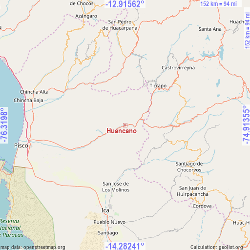
Huancano GPS coordinates[2]
13° 36' 0" South, 75° 37' 0.012" West
| Map corner | latitude | longitude |
|---|---|---|
| Upper-left | -12.91562°, | -76.3198° |
| Center: | -13.6°, | -75.61667° |
| Lower-right: | -14.28241°, | -74.91355° |
| Map W x H: | 152×152 km | = 94.4×94.4mi |
| max Lat: | -0.96667° ⇑68.1% North |
| Huancano: | -13.6° |
| min Lat: | ⇓31.9% South -18.01465° |
| min Long | Huancano | max Long |
| -81.30472° | -75.61667° | -69.04167° |
| W 51.3%⇐ | ⇒48.7% E |
Elevation
Elevation of Huancano is 1020 m = 3346 ft, and this is 1298.7 m = 4261 ft below average elevation for this country.
| Max E: |
5022 m = 16476 ft | 72.6% |
| Avg. | 2318.7 m = 7607 ft | |
| Huancano | 1020 m = 3346 ft | |
Min E: |
1 m = 3 ft | 27.4% |
See also: Peru elevation on elevation.city.
Geographical zone
Huancano is located in South Torrid zone (between Equator and Tropic of Capricorn). Distance of this Southern Tropic circle is 1093.7 km =679.6 mi to South.| Distance of | km | miles | from Huancano |
|---|---|---|---|
| Equator | 1512.2 | 939.6 | to North |
| Tropic Capricorn | 1093.7 | 679.6 | to South |
| Antarctic Circle | 5889 | 3659.3 | to South |
| South Pole | 8494.9 | 5278.5 | to South |


Nearby cities:
15 places around Huancano: (largest is in red/bold)
• Castrovirreyna
49.3 km =30.6 mi,  41°
41°
• Cocas
45.9 km =28.5 mi, 36°
• El Carmen
49 km =30.4 mi,  283°
283°
• Guadalupe
43.9 km =27.3 mi,  201°
201°
• Huachos
45.8 km =28.5 mi,  13°
13°
• Huayacundo Arma
34.4 km =21.4 mi,  78°
78°
• Humay
33.2 km =20.6 mi,  247°
247°
• Independencia
46.4 km =28.8 mi,  256°
256°
• La Tinguiña
49.3 km =30.6 mi,  190°
190°
• Mollepampa
40.8 km =25.4 mi, 35°
• Quito-Arma
31.5 km =19.6 mi, 76°
• San Juan
44.6 km =27.7 mi,  355°
355°
• San Juan Bautista
47.5 km =29.5 mi, 195°
• Subtanjalla
49 km =30.4 mi, 198°
• Ticrapo
35.2 km =21.9 mi, 37°
Sources, notices
• [Note1] Compared only with cities in Peru existing in our database
• [Src1] Map data: © OpenStreetMap contributors (CC-BY-SA)
• [Src2] Other city data from geonames.org with taken over terms of usage.
• [Src3] Geographical zone / Annual Mean Temperature by Robert A. Rohde @ Wikipedia
