Quito-Arma geodata
Quito-Arma (Huancavelica) is a seat of a third-order administrative division; located in Peru in America/Lima (GMT-5) time zone. In our database, there are 305 cities with bigger population. Compared to other cities in Peru, 67.1% of cities are located further ↑North; 54.9% of cities are located further ←West and 54.7% of cities have lower elevation than Quito-Arma. Note1


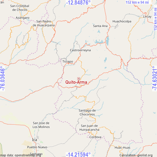
Quito-Arma GPS coordinates[2]
13° 31' 59.988" South, 75° 19' 59.988" West
| Map corner | latitude | longitude |
|---|---|---|
| Upper-left | -12.84876°, | -76.03646° |
| Center: | -13.53333°, | -75.33333° |
| Lower-right: | -14.21594°, | -74.63021° |
| Map W x H: | 152×152 km | = 94.4×94.4mi |
| max Lat: | -0.96667° ⇑67.1% North |
| Quito-Arma: | -13.53333° |
| min Lat: | ⇓32.9% South -18.01465° |
| min Long | Quito-Arma | max Long |
| -81.30472° | -75.33333° | -69.04167° |
| W 54.9%⇐ | ⇒45.1% E |
Elevation
Elevation of Quito-Arma is 3016 m = 9895 ft, and this is 697.3 m = 2288 ft above average elevation for this country.
| Max E: |
5022 m = 16476 ft | 45.3% |
| Quito-Arma | 3016 m 9895 ft | |
| Avg. | 2318.7 m = 7607 ft | |
Min E: |
1 m = 3 ft | 54.7% |
See also: Peru elevation on elevation.city.
Geographical zone
Quito-Arma is located in South Torrid zone (between Equator and Tropic of Capricorn). Distance of this Southern Tropic circle is 1101.2 km =684.3 mi to South.| Distance of | km | miles | from Quito-Arma |
|---|---|---|---|
| Equator | 1504.8 | 935 | to North |
| Tropic Capricorn | 1101.2 | 684.3 | to South |
| Antarctic Circle | 5896.4 | 3663.9 | to South |
| South Pole | 8502.3 | 5283.1 | to South |


Nearby cities:
15 places around Quito-Arma: (largest is in red/bold)
• Arma
51.1 km =31.8 mi,  334°
334°
• Castrovirreyna
29.7 km =18.5 mi,  3°
3°
• Chupamarca
62.6 km =38.9 mi, 332°
• Cocas
29.9 km =18.6 mi,  353°
353°
• Huachos
42 km =26.1 mi, 331°
• Huamatambo
59.8 km =37.2 mi,  320°
320°
• Huancano
31.5 km =19.6 mi,  256°
256°
• Huayacundo Arma
3.1 km =1.9 mi,  96°
96°
• Humay
64.5 km =40.1 mi,  251°
251°
• Mollepampa
26.9 km =16.7 mi,  344°
344°
• Ocoyo
62.6 km =38.9 mi,  147°
147°
• Pilpichaca
43 km =26.7 mi,  57°
57°
• San Juan
50.5 km =31.4 mi, 317°
• Santa Ana
57.9 km =36 mi,  21°
21°
• Ticrapo
22.3 km =13.9 mi, 336°
Sources, notices
• [Note1] Compared only with cities in Peru existing in our database
• [Src1] Map data: © OpenStreetMap contributors (CC-BY-SA)
• [Src2] Other city data from geonames.org with taken over terms of usage.
• [Src3] Geographical zone / Annual Mean Temperature by Robert A. Rohde @ Wikipedia
