Lluta geodata
Lluta (Arequipa) is a seat of a third-order administrative division; located in Peru in America/Lima (GMT-5) time zone. With population of 5,998 people, there are 207 cities with bigger population in this country. Compared to other cities in Peru, 93.6% of cities are located further ↑North; 80.9% of cities are located further ←West and 55.2% of cities have lower elevation than Lluta. Note1


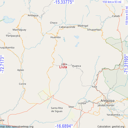
Lluta GPS coordinates[2]
16° 0' 52.992" South, 72° 0' 51.012" West
| Map corner | latitude | longitude |
|---|---|---|
| Upper-left | -15.33775°, | -72.7173° |
| Center: | -16.01472°, | -72.01417° |
| Lower-right: | -16.6894°, | -71.31105° |
| Map W x H: | 150.3×150.3 km | = 93.4×93.4mi |
| max Lat: | -0.96667° ⇑93.6% North |
| Lluta: | -16.01472° |
| min Lat: | ⇓6.4% South -18.01465° |
| min Long | Lluta | max Long |
| -81.30472° | -72.01417° | -69.04167° |
| W 80.9%⇐ | ⇒19.1% E |
Elevation
Elevation of Lluta is 3023 m = 9918 ft, and this is 704.3 m = 2311 ft above average elevation for this country.
| Max E: |
5022 m = 16476 ft | 44.8% |
| Lluta | 3023 m 9918 ft | |
| Avg. | 2318.7 m = 7607 ft | |
Min E: |
1 m = 3 ft | 55.2% |
See also: Peru elevation on elevation.city.
Geographical zone
Lluta is located in South Torrid zone (between Equator and Tropic of Capricorn). Distance of this Southern Tropic circle is 825.2 km =512.8 mi to South.| Distance of | km | miles | from Lluta |
|---|---|---|---|
| Equator | 1780.7 | 1106.5 | to North |
| Tropic Capricorn | 825.2 | 512.8 | to South |
| Antarctic Circle | 5620.5 | 3492.4 | to South |
| South Pole | 8226.4 | 5111.6 | to South |


Nearby cities:
15 places around Lluta: (largest is in red/bold)
• Achoma
51.7 km =32.1 mi,  40°
40°
• Aplao
51.7 km =32.1 mi,  262°
262°
• Ayo
46.3 km =28.8 mi,  323°
323°
• Cabanaconde
43.9 km =27.3 mi,  4°
4°
• Choco
50.4 km =31.3 mi,  345°
345°
• Corire
54.1 km =33.6 mi,  244°
244°
• Huambo
33.1 km =20.6 mi,  342°
342°
• Huancarqui
49.8 km =30.9 mi, 259°
• Ichupampa
53.6 km =33.3 mi, 40°
• Lari
50.9 km =31.6 mi,  31°
31°
• Maca
49 km =30.4 mi, 32°
• Madrigal
50.3 km =31.3 mi, 25°
• Tapay
49.2 km =30.6 mi,  9°
9°
• Uñon
54.6 km =33.9 mi,  305°
305°
• Yura
44.4 km =27.6 mi,  126°
126°
Sources, notices
• [Note1] Compared only with cities in Peru existing in our database
• [Src1] Map data: © OpenStreetMap contributors (CC-BY-SA)
• [Src2] Other city data from geonames.org with taken over terms of usage.
• [Src3] Geographical zone / Annual Mean Temperature by Robert A. Rohde @ Wikipedia
