Cuyocuyo geodata
Cuyocuyo (Puno) is a seat of a third-order administrative division; located in Peru in America/Lima (GMT-5) time zone. In our database, there are 305 cities with bigger population. Compared to other cities in Peru, 82.1% of cities are located further ↑North; 98.5% of cities are located further ←West and 74.7% of cities have lower elevation than Cuyocuyo. Note1


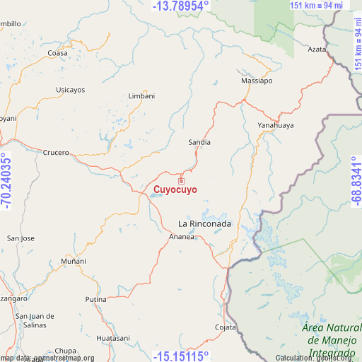
Cuyocuyo GPS coordinates[2]
14° 28' 17.004" South, 69° 32' 13.992" West
| Map corner | latitude | longitude |
|---|---|---|
| Upper-left | -13.78954°, | -70.24035° |
| Center: | -14.47139°, | -69.53722° |
| Lower-right: | -15.15115°, | -68.8341° |
| Map W x H: | 151.4×151.4 km | = 94.1×94.1mi |
| max Lat: | -0.96667° ⇑82.1% North |
| Cuyocuyo: | -14.47139° |
| min Lat: | ⇓17.9% South -18.01465° |
| min Long | Cuyocuyo | max Long |
| -81.30472° | -69.53722° | -69.04167° |
| W 98.5%⇐ | ⇒1.5% E |
Elevation
Elevation of Cuyocuyo is 3427 m = 11243 ft, and this is 1108.3 m = 3636 ft above average elevation for this country.
| Max E: |
5022 m = 16476 ft | 25.3% |
| Cuyocuyo | 3427 m 11243 ft | |
| Avg. | 2318.7 m = 7607 ft | |
Min E: |
1 m = 3 ft | 74.7% |
See also: Peru elevation on elevation.city.
Geographical zone
Cuyocuyo is located in South Torrid zone (between Equator and Tropic of Capricorn). Distance of this Southern Tropic circle is 996.9 km =619.4 mi to South.| Distance of | km | miles | from Cuyocuyo |
|---|---|---|---|
| Equator | 1609.1 | 999.8 | to North |
| Tropic Capricorn | 996.9 | 619.4 | to South |
| Antarctic Circle | 5792.1 | 3599 | to South |
| South Pole | 8398 | 5218.3 | to South |


Nearby cities:
15 places around Cuyocuyo: (largest is in red/bold)
• Ananea
25.5 km =15.8 mi,  183°
183°
• Crucero
51.6 km =32.1 mi,  285°
285°
• Inchupalla
60.8 km =37.8 mi,  194°
194°
• La Rinconada
20.3 km =12.6 mi,  151°
151°
• Limbani
39.5 km =24.5 mi,  335°
335°
• Muñani
55.2 km =34.3 mi,  233°
233°
• Patambuco
15.2 km =9.4 mi,  324°
324°
• Phara
38 km =23.6 mi, 339°
• Potoni
59.6 km =37 mi,  279°
279°
• Putina
60.9 km =37.8 mi,  215°
215°
• Quiaca
20.6 km =12.8 mi,  78°
78°
• Sandia
28.7 km =17.8 mi,  22°
22°
• Sina
27.5 km =17.1 mi,  96°
96°
• Usicayos
60.2 km =37.4 mi,  309°
309°
• Yanahuaya
42.9 km =26.7 mi,  57°
57°
Sources, notices
• [Note1] Compared only with cities in Peru existing in our database
• [Src1] Map data: © OpenStreetMap contributors (CC-BY-SA)
• [Src2] Other city data from geonames.org with taken over terms of usage.
• [Src3] Geographical zone / Annual Mean Temperature by Robert A. Rohde @ Wikipedia
