Yanahuaya geodata
Yanahuaya (Puno) is a seat of a third-order administrative division; located in Peru in America/Lima (GMT-5) time zone. In our database, there are 305 cities with bigger population. Compared to other cities in Peru, 79.5% of cities are located further ↑North; 99.7% of cities are located further ←West and 66.9% of cities have higher elevation than Yanahuaya. Note1


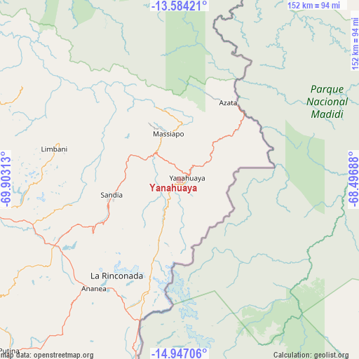
Yanahuaya GPS coordinates[2]
14° 16' 0.012" South, 69° 12' 0" West
| Map corner | latitude | longitude |
|---|---|---|
| Upper-left | -13.58421°, | -69.90313° |
| Center: | -14.26667°, | -69.2° |
| Lower-right: | -14.94706°, | -68.49688° |
| Map W x H: | 151.5×151.5 km | = 94.1×94.1mi |
| max Lat: | -0.96667° ⇑79.5% North |
| Yanahuaya: | -14.26667° |
| min Lat: | ⇓20.5% South -18.01465° |
| min Long | Yanahuaya | max Long |
| -81.30472° | -69.2° | -69.04167° |
| W 99.7%⇐ | ⇒0.3% E |
Elevation
Elevation of Yanahuaya is 1907 m = 6257 ft, and this is 411.7 m = 1351 ft below average elevation for this country.
| Max E: |
5022 m = 16476 ft | 66.9% |
| Avg. | 2318.7 m = 7607 ft | |
| Yanahuaya | 1907 m = 6257 ft | |
Min E: |
1 m = 3 ft | 33.1% |
See also: Peru elevation on elevation.city.
Geographical zone
Yanahuaya is located in South Torrid zone (between Equator and Tropic of Capricorn). Distance of this Southern Tropic circle is 1019.6 km =633.5 mi to South.| Distance of | km | miles | from Yanahuaya |
|---|---|---|---|
| Equator | 1586.3 | 985.7 | to North |
| Tropic Capricorn | 1019.6 | 633.5 | to South |
| Antarctic Circle | 5814.9 | 3613.2 | to South |
| South Pole | 8420.8 | 5232.4 | to South |


Nearby cities:
15 places around Yanahuaya: (largest is in red/bold)
• Ananea
61.2 km =38 mi,  218°
218°
• Coasa
87.8 km =54.6 mi,  289°
289°
• Cojata
85.3 km =53 mi,  192°
192°
• Crucero
86.7 km =53.9 mi,  263°
263°
• Cuyocuyo
42.9 km =26.7 mi,  237°
237°
• Inchupalla
96.7 km =60.1 mi,  212°
212°
• La Rinconada
48.4 km =30.1 mi, 213°
• Limbani
54.3 km =33.7 mi,  284°
284°
• Patambuco
46.3 km =28.8 mi, 257°
• Phara
51.5 km =32 mi, 284°
• Potoni
96 km =59.7 mi, 262°
• Quiaca
24.6 km =15.3 mi, 221°
• Sandia
25.4 km =15.8 mi, 278°
• Sina
27.5 km =17.1 mi,  199°
199°
• Usicayos
84.1 km =52.3 mi, 280°
Sources, notices
• [Note1] Compared only with cities in Peru existing in our database
• [Src1] Map data: © OpenStreetMap contributors (CC-BY-SA)
• [Src2] Other city data from geonames.org with taken over terms of usage.
• [Src3] Geographical zone / Annual Mean Temperature by Robert A. Rohde @ Wikipedia
