Corpanqui geodata
Corpanqui (Ancash) is a seat of a third-order administrative division; located in Peru in America/Lima (GMT-5) time zone. In our database, there are 305 cities with bigger population. Compared to other cities in Peru, 59.2% of cities are located further ↓South; 69.6% of cities are located further →East and 71.9% of cities have lower elevation than Corpanqui. Note1
Administrative division(s):
- Level 1: Ancash
- Level 2: Provincia de Bolognesi
- Level 3: San Miguel De Corpanqui


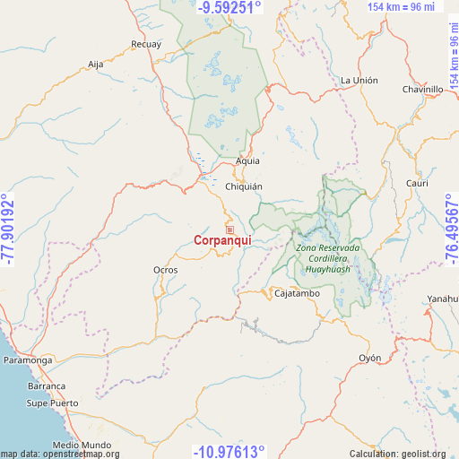
Corpanqui GPS coordinates[2]
10° 17' 6.288" South, 77° 11' 55.644" West
| Map corner | latitude | longitude |
|---|---|---|
| Upper-left | -9.59251°, | -77.90192° |
| Center: | -10.28508°, | -77.19879° |
| Lower-right: | -10.97613°, | -76.49567° |
| Map W x H: | 153.8×153.8 km | = 95.6×95.6mi |
| max Lat: | -0.96667° ⇑40.8% North |
| Corpanqui: | -10.28508° |
| min Lat: | ⇓59.2% South -18.01465° |
| min Long | Corpanqui | max Long |
| -81.30472° | -77.19879° | -69.04167° |
| W 30.4%⇐ | ⇒69.6% E |
Elevation
Elevation of Corpanqui is 3381 m = 11093 ft, and this is 1062.3 m = 3485 ft above average elevation for this country.
| Max E: |
5022 m = 16476 ft | 28.1% |
| Corpanqui | 3381 m 11093 ft | |
| Avg. | 2318.7 m = 7607 ft | |
Min E: |
1 m = 3 ft | 71.9% |
See also: Peru elevation on elevation.city.
Geographical zone
Corpanqui is located in South Torrid zone (between Equator and Tropic of Capricorn). Distance of Equator is 1143.6 km =710.6 mi to North.| Distance of | km | miles | from Corpanqui |
|---|---|---|---|
| Equator | 1143.6 | 710.6 | to North |
| Tropic Capricorn | 1462.3 | 908.6 | to South |
| Antarctic Circle | 6257.6 | 3888.3 | to South |
| South Pole | 8863.5 | 5507.5 | to South |


Nearby cities:
15 places around Corpanqui: (largest is in red/bold)
• Acas
23.8 km =14.8 mi,  216°
216°
• Aco
24 km =14.9 mi,  191°
191°
• Aquia
24.2 km =15 mi,  14°
14°
• Cajacay
30.1 km =18.7 mi,  298°
298°
• Canis
6.8 km =4.2 mi,  151°
151°
• Congas
27.2 km =16.9 mi,  257°
257°
• Copa
17.4 km =10.8 mi,  131°
131°
• Copa
33 km =20.5 mi,  253°
253°
• Huasta
18.5 km =11.5 mi, 14°
• Llaclla
6 km =3.7 mi,  104°
104°
• Llipa
10.8 km =6.7 mi,  184°
184°
• Mangas
14.5 km =9 mi, 133°
• Ocros
25.3 km =15.7 mi,  238°
238°
• Pampas Chico
28.8 km =17.9 mi,  310°
310°
• Ticllos
3.6 km =2.2 mi, 14°
Sources, notices
• [Note1] Compared only with cities in Peru existing in our database
• [Src1] Map data: © OpenStreetMap contributors (CC-BY-SA)
• [Src2] Other city data from geonames.org with taken over terms of usage.
• [Src3] Geographical zone / Annual Mean Temperature by Robert A. Rohde @ Wikipedia
