Chivay geodata
Chivay (Arequipa) is a seat of a third-order administrative division; located in Peru in America/Lima (GMT-5) time zone. With population of 4,543 people, there are 245 cities with bigger population in this country. Compared to other cities in Peru, 90.8% of cities are located further ↑North; 84.4% of cities are located further ←West and 84.3% of cities have lower elevation than Chivay. Note1


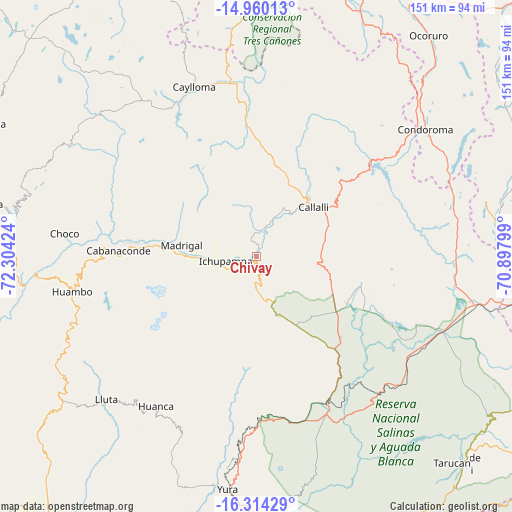
Chivay GPS coordinates[2]
15° 38' 17.988" South, 71° 36' 3.996" West
| Map corner | latitude | longitude |
|---|---|---|
| Upper-left | -14.96013°, | -72.30424° |
| Center: | -15.63833°, | -71.60111° |
| Lower-right: | -16.31429°, | -70.89799° |
| Map W x H: | 150.6×150.6 km | = 93.6×93.6mi |
| max Lat: | -0.96667° ⇑90.8% North |
| Chivay: | -15.63833° |
| min Lat: | ⇓9.2% South -18.01465° |
| min Long | Chivay | max Long |
| -81.30472° | -71.60111° | -69.04167° |
| W 84.4%⇐ | ⇒15.6% E |
Elevation
Elevation of Chivay is 3639 m = 11939 ft, and this is 1320.3 m = 4332 ft above average elevation for this country.
| Max E: |
5022 m = 16476 ft | 15.7% |
| Chivay | 3639 m 11939 ft | |
| Avg. | 2318.7 m = 7607 ft | |
Min E: |
1 m = 3 ft | 84.3% |
See also: Peru elevation on elevation.city.
Geographical zone
Chivay is located in South Torrid zone (between Equator and Tropic of Capricorn). Distance of this Southern Tropic circle is 867.1 km =538.8 mi to South.| Distance of | km | miles | from Chivay |
|---|---|---|---|
| Equator | 1738.8 | 1080.4 | to North |
| Tropic Capricorn | 867.1 | 538.8 | to South |
| Antarctic Circle | 5662.4 | 3518.5 | to South |
| South Pole | 8268.2 | 5137.6 | to South |


Nearby cities:
15 places around Chivay: (largest is in red/bold)
• Achoma
11 km =6.8 mi,  256°
256°
• Callalli
22.1 km =13.7 mi,  49°
49°
• Ccolo
18.8 km =11.7 mi,  38°
38°
• Coporaque
5 km =3.1 mi,  284°
284°
• Huarancante
20.9 km =13 mi,  133°
133°
• Ichupampa
9.3 km =5.8 mi, 262°
• Jatun Orcochiri
30 km =18.6 mi,  114°
114°
• Jayune
33 km =20.5 mi,  75°
75°
• Lari
18.1 km =11.2 mi, 275°
• Llongasora
32.3 km =20.1 mi,  90°
90°
• Maca
18 km =11.2 mi,  268°
268°
• Madrigal
22.4 km =13.9 mi, 278°
• Sibayo
22.7 km =14.1 mi, 42°
• Tuti
12.9 km =8 mi,  24°
24°
• Yanque
6.2 km =3.9 mi, 258°
Sources, notices
• [Note1] Compared only with cities in Peru existing in our database
• [Src1] Map data: © OpenStreetMap contributors (CC-BY-SA)
• [Src2] Other city data from geonames.org with taken over terms of usage.
• [Src3] Geographical zone / Annual Mean Temperature by Robert A. Rohde @ Wikipedia
