Achoma geodata
Achoma (Arequipa) is a seat of a third-order administrative division; located in Peru in America/Lima (GMT-5) time zone. In our database, there are 305 cities with bigger population. Compared to other cities in Peru, 91.5% of cities are located further ↑North; 83.3% of cities are located further ←West and 78.3% of cities have lower elevation than Achoma. Note1


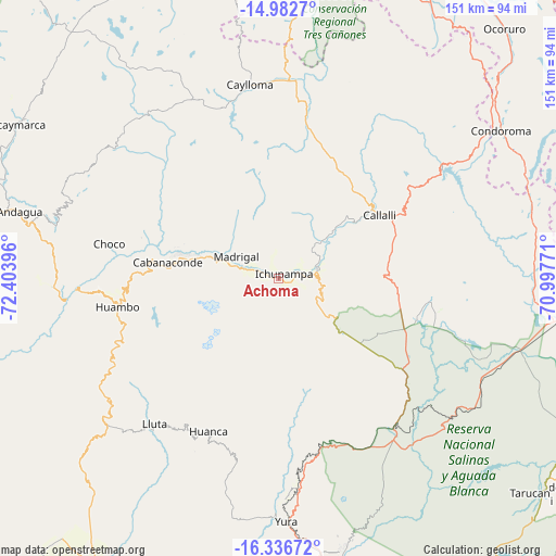
Achoma GPS coordinates[2]
15° 39' 38.988" South, 71° 42' 2.988" West
| Map corner | latitude | longitude |
|---|---|---|
| Upper-left | -14.9827°, | -72.40396° |
| Center: | -15.66083°, | -71.70083° |
| Lower-right: | -16.33672°, | -70.99771° |
| Map W x H: | 150.6×150.6 km | = 93.6×93.6mi |
| max Lat: | -0.96667° ⇑91.5% North |
| Achoma: | -15.66083° |
| min Lat: | ⇓8.5% South -18.01465° |
| min Long | Achoma | max Long |
| -81.30472° | -71.70083° | -69.04167° |
| W 83.3%⇐ | ⇒16.7% E |
Elevation
Elevation of Achoma is 3488 m = 11444 ft, and this is 1169.3 m = 3836 ft above average elevation for this country.
| Max E: |
5022 m = 16476 ft | 21.7% |
| Achoma | 3488 m 11444 ft | |
| Avg. | 2318.7 m = 7607 ft | |
Min E: |
1 m = 3 ft | 78.3% |
See also: Peru elevation on elevation.city.
Geographical zone
Achoma is located in South Torrid zone (between Equator and Tropic of Capricorn). Distance of this Southern Tropic circle is 864.6 km =537.2 mi to South.| Distance of | km | miles | from Achoma |
|---|---|---|---|
| Equator | 1741.3 | 1082 | to North |
| Tropic Capricorn | 864.6 | 537.2 | to South |
| Antarctic Circle | 5659.9 | 3516.9 | to South |
| South Pole | 8265.7 | 5136.1 | to South |


Nearby cities:
15 places around Achoma: (largest is in red/bold)
• Cabanaconde
30.1 km =18.7 mi,  278°
278°
• Callalli
32.2 km =20 mi,  58°
58°
• Ccolo
28.2 km =17.5 mi,  52°
52°
• Chivay
11 km =6.8 mi,  76°
76°
• Coporaque
6.9 km =4.3 mi, 57°
• Huarancante
28.4 km =17.6 mi,  114°
114°
• Ichupampa
1.9 km =1.2 mi, 49°
• Jatun Orcochiri
39.2 km =24.4 mi,  104°
104°
• Lari
8.5 km =5.3 mi,  300°
300°
• Maca
7.6 km =4.7 mi,  286°
286°
• Madrigal
12.9 km =8 mi, 297°
• Sibayo
32.4 km =20.1 mi, 53°
• Tapay
27.1 km =16.8 mi, 289°
• Tuti
21.4 km =13.3 mi, 48°
• Yanque
4.8 km =3 mi,  74°
74°
Sources, notices
• [Note1] Compared only with cities in Peru existing in our database
• [Src1] Map data: © OpenStreetMap contributors (CC-BY-SA)
• [Src2] Other city data from geonames.org with taken over terms of usage.
• [Src3] Geographical zone / Annual Mean Temperature by Robert A. Rohde @ Wikipedia
