Jatun Orcochiri geodata
Jatun Orcochiri (Arequipa) is a populated place; located in Peru in America/Lima (GMT-5) time zone. With population of 4,358 people, there are 255 cities with bigger population in this country. Compared to other cities in Peru, 92.2% of cities are located further ↑North; 87.6% of cities are located further ←West and 98.3% of cities have lower elevation than Jatun Orcochiri. Note1


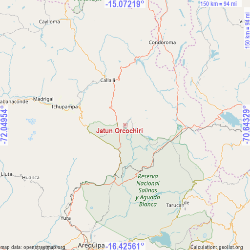
Jatun Orcochiri GPS coordinates[2]
15° 45' 0.108" South, 71° 20' 47.076" West
| Map corner | latitude | longitude |
|---|---|---|
| Upper-left | -15.07219°, | -72.04954° |
| Center: | -15.75003°, | -71.34641° |
| Lower-right: | -16.42561°, | -70.64329° |
| Map W x H: | 150.5×150.5 km | = 93.5×93.5mi |
| max Lat: | -0.96667° ⇑92.2% North |
| Jatun Orcochiri: | -15.75003° |
| min Lat: | ⇓7.8% South -18.01465° |
| min Long | Jatun Orcochiri | max Long |
| -81.30472° | -71.34641° | -69.04167° |
| W 87.6%⇐ | ⇒12.4% E |
Elevation
Elevation of Jatun Orcochiri is 4327 m = 14196 ft, and this is 2008.3 m = 6589 ft above average elevation for this country.
| Max E: |
5022 m = 16476 ft | 1.7% |
| Jatun Orcochiri | 4327 m 14196 ft | |
| Avg. | 2318.7 m = 7607 ft | |
Min E: |
1 m = 3 ft | 98.3% |
See also: Peru elevation on elevation.city.
Geographical zone
Jatun Orcochiri is located in South Torrid zone (between Equator and Tropic of Capricorn). Distance of this Southern Tropic circle is 854.7 km =531.1 mi to South.| Distance of | km | miles | from Jatun Orcochiri |
|---|---|---|---|
| Equator | 1751.2 | 1088.1 | to North |
| Tropic Capricorn | 854.7 | 531.1 | to South |
| Antarctic Circle | 5649.9 | 3510.7 | to South |
| South Pole | 8255.8 | 5129.9 | to South |


Nearby cities:
15 places around Jatun Orcochiri: (largest is in red/bold)
• Achoma
39.2 km =24.4 mi,  284°
284°
• Callalli
28.9 km =18 mi,  338°
338°
• Ccolo
31.3 km =19.4 mi,  330°
330°
• Chivay
30 km =18.6 mi,  294°
294°
• Coporaque
34.9 km =21.7 mi, 293°
• Huarancante
12.3 km =7.6 mi,  260°
260°
• Huarichancara
32.9 km =20.4 mi,  68°
68°
• Ichupampa
38.2 km =23.7 mi, 286°
• Jayune
21.3 km =13.2 mi,  12°
12°
• Llongasora
13.3 km =8.3 mi,  22°
22°
• Pucara
28.3 km =17.6 mi,  205°
205°
• Sibayo
31.6 km =19.6 mi, 337°
• Tuti
32.6 km =20.3 mi,  317°
317°
• Vizcachane
16.9 km =10.5 mi,  112°
112°
• Yanque
35.2 km =21.9 mi, 288°
Sources, notices
• [Note1] Compared only with cities in Peru existing in our database
• [Src1] Map data: © OpenStreetMap contributors (CC-BY-SA)
• [Src2] Other city data from geonames.org with taken over terms of usage.
• [Src3] Geographical zone / Annual Mean Temperature by Robert A. Rohde @ Wikipedia
