Chilca geodata
Chilca (Lima region) is a seat of a third-order administrative division; located in Peru in America/Lima (GMT-5) time zone. With population of 12,884 people, there are 127 cities with bigger population in this country. Compared to other cities in Peru, 57.6% of cities are located further ↑North; 63.2% of cities are located further →East and 98.8% of cities have higher elevation than Chilca. Note1


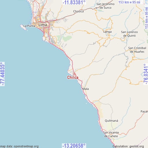
Chilca GPS coordinates[2]
12° 31' 15.996" South, 76° 44' 13.992" West
| Map corner | latitude | longitude |
|---|---|---|
| Upper-left | -11.83381°, | -77.44035° |
| Center: | -12.52111°, | -76.73722° |
| Lower-right: | -13.20658°, | -76.0341° |
| Map W x H: | 152.6×152.6 km | = 94.8×94.8mi |
| max Lat: | -0.96667° ⇑57.6% North |
| Chilca: | -12.52111° |
| min Lat: | ⇓42.4% South -18.01465° |
| min Long | Chilca | max Long |
| -81.30472° | -76.73722° | -69.04167° |
| W 36.8%⇐ | ⇒63.2% E |
Elevation
Elevation of Chilca is 11 m = 36 ft, and this is 2307.7 m = 7571 ft below average elevation for this country.
| Max E: |
5022 m = 16476 ft | 98.8% |
| Avg. | 2318.7 m = 7607 ft | |
| Chilca | 11 m = 36 ft | |
Min E: |
1 m = 3 ft | 1.2% |
See also: Peru elevation on elevation.city.
Geographical zone
Chilca is located in South Torrid zone (between Equator and Tropic of Capricorn). Distance of this Southern Tropic circle is 1213.7 km =754.2 mi to South.| Distance of | km | miles | from Chilca |
|---|---|---|---|
| Equator | 1392.2 | 865.1 | to North |
| Tropic Capricorn | 1213.7 | 754.2 | to South |
| Antarctic Circle | 6009 | 3733.8 | to South |
| South Pole | 8614.8 | 5353 | to South |


Nearby cities:
15 places around Chilca: (largest is in red/bold)
• Asia
34.5 km =21.4 mi,  147°
147°
• Calango
21.1 km =13.1 mi,  91°
91°
• Cieneguilla
44 km =27.3 mi,  348°
348°
• Coayllo
37.7 km =23.4 mi,  128°
128°
• La Molina
53.9 km =33.5 mi,  334°
334°
• Mala
19.1 km =11.9 mi,  142°
142°
• Mariatana
53.2 km =33.1 mi,  55°
55°
• Omas
49.3 km =30.6 mi, 89°
• Pucusana
8 km =5 mi,  301°
301°
• Punta Hermosa
22.6 km =14 mi,  337°
337°
• Quinocay
57.3 km =35.6 mi,  72°
72°
• San Bartolo
16.1 km =10 mi, 341°
• San Isidro
56.4 km =35 mi,  322°
322°
• San Luis
56.8 km =35.3 mi, 330°
• Santiago de Surco
51.9 km =32.2 mi, 325°
Sources, notices
• [Note1] Compared only with cities in Peru existing in our database
• [Src1] Map data: © OpenStreetMap contributors (CC-BY-SA)
• [Src2] Other city data from geonames.org with taken over terms of usage.
• [Src3] Geographical zone / Annual Mean Temperature by Robert A. Rohde @ Wikipedia
