San Bartolo geodata
San Bartolo (Lima region) is a seat of a third-order administrative division; located in Peru in America/Lima (GMT-5) time zone. With population of 5,733 people, there are 218 cities with bigger population in this country. Compared to other cities in Peru, 56.7% of cities are located further ↑North; 64.4% of cities are located further →East and 96.3% of cities have higher elevation than San Bartolo. Note1


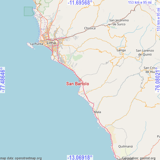
San Bartolo GPS coordinates[2]
12° 22' 59.988" South, 76° 46' 59.988" West
| Map corner | latitude | longitude |
|---|---|---|
| Upper-left | -11.69568°, | -77.48646° |
| Center: | -12.38333°, | -76.78333° |
| Lower-right: | -13.06918°, | -76.08021° |
| Map W x H: | 152.7×152.7 km | = 94.9×94.9mi |
| max Lat: | -0.96667° ⇑56.7% North |
| San Bartolo: | -12.38333° |
| min Lat: | ⇓43.3% South -18.01465° |
| min Long | San Bartolo | max Long |
| -81.30472° | -76.78333° | -69.04167° |
| W 35.6%⇐ | ⇒64.4% E |
Elevation
Elevation of San Bartolo is 22 m = 72 ft, and this is 2296.7 m = 7535 ft below average elevation for this country.
| Max E: |
5022 m = 16476 ft | 96.3% |
| Avg. | 2318.7 m = 7607 ft | |
| San Bartolo | 22 m = 72 ft | |
Min E: |
1 m = 3 ft | 3.7% |
See also: Peru elevation on elevation.city.
Geographical zone
San Bartolo is located in South Torrid zone (between Equator and Tropic of Capricorn). Distance of this Southern Tropic circle is 1229 km =763.7 mi to South.| Distance of | km | miles | from San Bartolo |
|---|---|---|---|
| Equator | 1376.9 | 855.6 | to North |
| Tropic Capricorn | 1229 | 763.7 | to South |
| Antarctic Circle | 6024.3 | 3743.3 | to South |
| South Pole | 8630.2 | 5362.6 | to South |


Nearby cities:
15 places around San Bartolo: (largest is in red/bold)
• Calango
30.6 km =19 mi,  121°
121°
• Chaclacayo
44.6 km =27.7 mi,  2°
2°
• Chilca
16.1 km =10 mi,  161°
161°
• Chosica
49.6 km =30.8 mi,  9°
9°
• Cieneguilla
28 km =17.4 mi,  352°
352°
• La Molina
38 km =23.6 mi,  331°
331°
• Lima
46.2 km =28.7 mi,  324°
324°
• Mala
34.7 km =21.6 mi,  151°
151°
• Pucusana
11.3 km =7 mi,  189°
189°
• Punta Hermosa
6.6 km =4.1 mi, 326°
• San Isidro
41.5 km =25.8 mi, 315°
• San Luis
41.1 km =25.5 mi, 326°
• Santa María
43.7 km =27.2 mi,  344°
344°
• Santiago de Surco
36.7 km =22.8 mi, 318°
• Vitarte
42.2 km =26.2 mi, 337°
Sources, notices
• [Note1] Compared only with cities in Peru existing in our database
• [Src1] Map data: © OpenStreetMap contributors (CC-BY-SA)
• [Src2] Other city data from geonames.org with taken over terms of usage.
• [Src3] Geographical zone / Annual Mean Temperature by Robert A. Rohde @ Wikipedia
