Huayllo geodata
Huayllo (Apurímac) is a seat of a third-order administrative division; located in Peru in America/Lima (GMT-5) time zone. In our database, there are 305 cities with bigger population. Compared to other cities in Peru, 76.9% of cities are located further ↑North; 71.6% of cities are located further ←West and 59.3% of cities have lower elevation than Huayllo. Note1


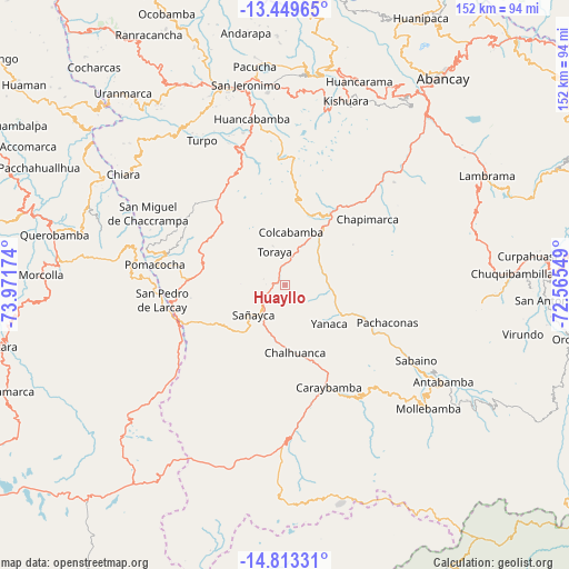
Huayllo GPS coordinates[2]
14° 7' 57" South, 73° 16' 6.996" West
| Map corner | latitude | longitude |
|---|---|---|
| Upper-left | -13.44965°, | -73.97174° |
| Center: | -14.1325°, | -73.26861° |
| Lower-right: | -14.81331°, | -72.56549° |
| Map W x H: | 151.6×151.6 km | = 94.2×94.2mi |
| max Lat: | -0.96667° ⇑76.9% North |
| Huayllo: | -14.1325° |
| min Lat: | ⇓23.1% South -18.01465° |
| min Long | Huayllo | max Long |
| -81.30472° | -73.26861° | -69.04167° |
| W 71.6%⇐ | ⇒28.4% E |
Elevation
Elevation of Huayllo is 3135 m = 10285 ft, and this is 816.3 m = 2678 ft above average elevation for this country.
| Max E: |
5022 m = 16476 ft | 40.7% |
| Huayllo | 3135 m 10285 ft | |
| Avg. | 2318.7 m = 7607 ft | |
Min E: |
1 m = 3 ft | 59.3% |
See also: Peru elevation on elevation.city.
Geographical zone
Huayllo is located in South Torrid zone (between Equator and Tropic of Capricorn). Distance of this Southern Tropic circle is 1034.5 km =642.8 mi to South.| Distance of | km | miles | from Huayllo |
|---|---|---|---|
| Equator | 1571.4 | 976.4 | to North |
| Tropic Capricorn | 1034.5 | 642.8 | to South |
| Antarctic Circle | 5829.8 | 3622.5 | to South |
| South Pole | 8435.7 | 5241.7 | to South |


Nearby cities:
15 places around Huayllo: (largest is in red/bold)
• Ayahuay
23.4 km =14.5 mi,  111°
111°
• Capaya
5.5 km =3.4 mi,  285°
285°
• Caraybamba
29.6 km =18.4 mi,  156°
156°
• Chalhuanca
19.1 km =11.9 mi,  167°
167°
• Chapimarca
28.1 km =17.5 mi,  51°
51°
• Colcabamba
14 km =8.7 mi,  9°
9°
• Lucre
20.9 km =13 mi, 12°
• Pachaconas
28 km =17.4 mi, 110°
• Pocohuanca
22.1 km =13.7 mi,  115°
115°
• Sañayca
11 km =6.8 mi,  221°
221°
• Soraya
5.8 km =3.6 mi,  234°
234°
• Tapairihua
13.6 km =8.5 mi,  93°
93°
• Tintay
21.2 km =13.2 mi,  24°
24°
• Toraya
9.6 km =6 mi,  341°
341°
• Yanaca
16.7 km =10.4 mi, 124°
Sources, notices
• [Note1] Compared only with cities in Peru existing in our database
• [Src1] Map data: © OpenStreetMap contributors (CC-BY-SA)
• [Src2] Other city data from geonames.org with taken over terms of usage.
• [Src3] Geographical zone / Annual Mean Temperature by Robert A. Rohde @ Wikipedia
