Kokopo geodata
Kokopo (East New Britain) is a seat of a first-order administrative division; located in Papua New Guinea in Pacific/Port_Moresby (GMT+10) time zone. With population of 26,273 people, there are 6 cities with bigger population in this country. Compared to other cities in Papua New Guinea, 81.8% of cities are located further ↓South; 88.6% of cities are located further ←West and 97.7% of cities have higher elevation than Kokopo. Note1


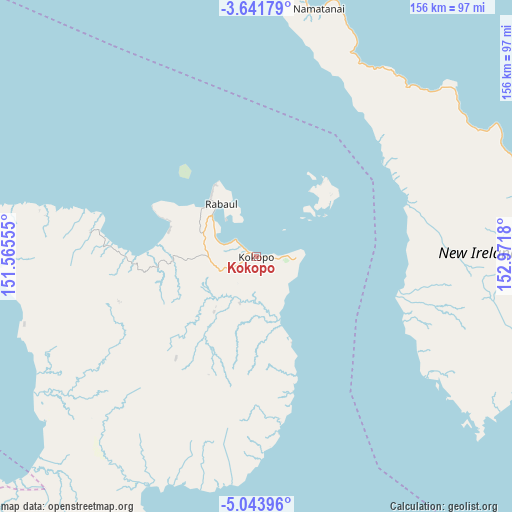
Kokopo GPS coordinates[2]
4° 20' 35.52" South, 152° 16' 7.212" East
| Map corner | latitude | longitude |
|---|---|---|
| Upper-left | -3.64179°, | 151.56555° |
| Center: | -4.3432°, | 152.26867° |
| Lower-right: | -5.04396°, | 152.9718° |
| Map W x H: | 155.9×155.9 km | = 96.9×96.9mi |
| max Lat: | -2.0341° ⇑18.2% North |
| Kokopo: | -4.3432° |
| min Lat: | ⇓81.8% South -10.61038° |
| min Long | Kokopo | max Long |
| 141.29061° | 152.26867° | 155.69147° |
| W 88.6%⇐ | ⇒11.4% E |
Elevation
Elevation of Kokopo is 1 m = 3 ft, and this is 580 m = 1903 ft below average elevation for this country.
| Max E: |
2248 m = 7375 ft | 97.7% |
| Avg. | 581 m = 1906 ft | |
| Kokopo | 1 m = 3 ft | |
Min E: |
0 m = 0 ft | 2.3% |
See also: Papua New Guinea elevation on elevation.city.
Geographical zone
Kokopo is located in South Torrid zone (between Equator and Tropic of Capricorn). Distance of Equator is 482.9 km =300.1 mi to North.| Distance of | km | miles | from Kokopo |
|---|---|---|---|
| Equator | 482.9 | 300.1 | to North |
| Tropic Capricorn | 2123 | 1319.2 | to South |
| Antarctic Circle | 6918.3 | 4298.8 | to South |
| South Pole | 9524.1 | 5918 | to South |


Nearby cities:
8 places around Kokopo: (largest is in red/bold)
• Arawa
421 km =261.6 mi,  119°
119°
• Buka
292.4 km =181.7 mi,  114°
114°
• Kandrian
365.6 km =227.2 mi,  235°
235°
• Kavieng
255.9 km =159 mi,  320°
320°
• Kieta
426.6 km =265.1 mi, 119°
• Kimbe
271.6 km =168.8 mi, 240°
• Panguna
418.2 km =259.9 mi, 121°
• Rabaul
19.7 km =12.2 mi, 323°
Sources, notices
• [Note1] Compared only with cities in Papua New Guinea existing in our database
• [Src1] Map data: © OpenStreetMap contributors (CC-BY-SA)
• [Src2] Other city data from geonames.org with taken over terms of usage.
• [Src3] Geographical zone / Annual Mean Temperature by Robert A. Rohde @ Wikipedia
