Wawa geodata
Wawa (Calabarzon) is a populated place; located in Philippines in Asia/Manila (GMT+8) time zone. With population of 4,416 people, there are 1532 cities with bigger population in this country. Compared to other cities in Philippines, 64.9% of cities are located further ↓South; 75% of cities are located further →East and 85.4% of cities have higher elevation than Wawa. Note1
Administrative division(s):
- Level 1: Calabarzon
- Level 2: Province of Batangas
- Level 3: Batangas City


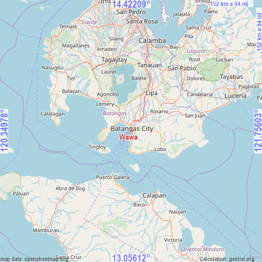
Wawa GPS coordinates[2]
13° 44' 24.36" North, 121° 3' 10.44" East
| Map corner | latitude | longitude |
|---|---|---|
| Upper-left | 14.42209°, | 120.34978° |
| Center: | 13.7401°, | 121.0529° |
| Lower-right: | 13.05612°, | 121.75603° |
| Map W x H: | 151.9×151.9 km | = 94.4×94.4mi |
| max Lat: | 20.78733° ⇑35.1% North |
| Wawa: | 13.7401° |
| min Lat: | ⇓64.9% South 4.65442° |
| min Long | Wawa | max Long |
| 117.04868° | 121.0529° | 126.58417° |
| W 25%⇐ | ⇒75% E |
Elevation
Elevation of Wawa is 8 m = 26 ft, and this is 79.9 m = 262 ft below average elevation for this country.
| Max E: |
2262 m = 7421 ft | 85.4% |
| Avg. | 87.9 m = 288 ft | |
| Wawa | 8 m = 26 ft | |
Min E: |
-2 m = -7 ft | 14.6% |
See also: Philippines elevation on elevation.city.
Geographical zone
Wawa is located in North Torrid zone (between Equator and Tropic of Cancer). Distance of this Northern Tropic circle is 1078.2 km =670 mi to North.| Distance of | km | miles | from Wawa |
|---|---|---|---|
| North Pole | 8479.3 | 5268.8 | to North |
| Arctic Circle | 5873.4 | 3649.6 | to North |
| Tropic Cancer | 1078.2 | 670 | to North |
| Equator | 1527.8 | 949.3 | to South |


Nearby cities:
15 places around Wawa: (largest is in red/bold)
• Batangas
1.9 km =1.2 mi,  17°
17°
• Bauan
7.5 km =4.7 mi,  320°
320°
• Bolo
9.5 km =5.9 mi,  305°
305°
• Bukal
11.6 km =7.2 mi, 22°
• Haligue
10.7 km =6.6 mi,  139°
139°
• Ibaan
12.2 km =7.6 mi,  45°
45°
• Ilihan
12.3 km =7.6 mi,  170°
170°
• Inicbulan
11.7 km =7.3 mi, 319°
• Mabini
12.2 km =7.6 mi,  276°
276°
• San Pascual
8.5 km =5.3 mi,  336°
336°
• Santa Clara
1.7 km =1.1 mi,  28°
28°
• Santa Rita Aplaya
4 km =2.5 mi,  331°
331°
• Santo Niño
6.2 km =3.9 mi,  133°
133°
• Sinala
11.2 km =7 mi, 310°
• Talahib Payap
12.6 km =7.8 mi, 134°
Sources, notices
• [Note1] Compared only with cities in Philippines existing in our database
• [Src1] Map data: © OpenStreetMap contributors (CC-BY-SA)
• [Src2] Other city data from geonames.org with taken over terms of usage.
• [Src3] Geographical zone / Annual Mean Temperature by Robert A. Rohde @ Wikipedia
