Batangas geodata
Batangas (Calabarzon) is a seat of a second-order administrative division; located in Philippines in Asia/Manila (GMT+8) time zone. With population of 237,370 people, there are 41 cities with bigger population in this country. Compared to other cities in Philippines, 65.1% of cities are located further ↓South; 74.9% of cities are located further →East and 60.8% of cities have higher elevation than Batangas. Note1
Administrative division(s):
- Level 1: Calabarzon
- Level 2: Province of Batangas
- Level 3: Batangas City


Batangas GPS coordinates[2]
13° 45' 24.12" North, 121° 3' 30.24" East
| Map corner | latitude | longitude |
|---|---|---|
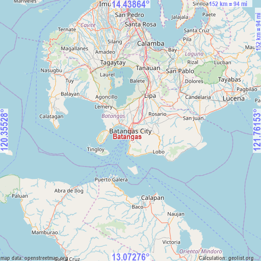
| Upper-left | 14.43864°, | 120.35528° |
| Center: | 13.7567°, | 121.0584° |
| Lower-right: | 13.07276°, | 121.76153° |
| Map W x H: | 151.9×151.9 km | = 94.4×94.4mi |
| max Lat: | 20.78733° ⇑34.9% North |
| Batangas: | 13.7567° |
| min Lat: | ⇓65.1% South 4.65442° |
| min Long | Batangas | max Long |
| 117.04868° | 121.0584° | 126.58417° |
| W 25.1%⇐ | ⇒74.9% E |
Elevation
Elevation of Batangas is 16 m = 52 ft, and this is 71.9 m = 236 ft below average elevation for this country.
| Max E: |
2262 m = 7421 ft | 60.8% |
| Avg. | 87.9 m = 288 ft | |
| Batangas | 16 m = 52 ft | |
Min E: |
-2 m = -7 ft | 39.2% |
See also: Batangas elevation on elevation.city.
Geographical zone
Batangas is located in North Torrid zone (between Equator and Tropic of Cancer). Distance of this Northern Tropic circle is 1076.3 km =668.8 mi to North.| Distance of | km | miles | from Batangas |
|---|---|---|---|
| North Pole | 8477.5 | 5267.7 | to North |
| Arctic Circle | 5871.6 | 3648.4 | to North |
| Tropic Cancer | 1076.3 | 668.8 | to North |
| Equator | 1529.6 | 950.4 | to South |


Nearby cities:
15 places around Batangas: (largest is in red/bold)
• Bauan
6.6 km =4.1 mi,  305°
305°
• Bolo
9.1 km =5.7 mi,  294°
294°
• Bukal
9.7 km =6 mi,  23°
23°
• Haligue
11.8 km =7.3 mi,  147°
147°
• Ibaan
10.5 km =6.5 mi,  49°
49°
• Inicbulan
10.8 km =6.7 mi, 311°
• Lapolapo
12.2 km =7.6 mi,  44°
44°
• Mabini
12.7 km =7.9 mi,  268°
268°
• San Pascual
7.2 km =4.5 mi,  326°
326°
• Santa Clara
0.4 km =0.2 mi, 145°
• Santa Rita Aplaya
3 km =1.9 mi,  303°
303°
• Santo Niño
7.3 km =4.5 mi, 147°
• Sinala
10.6 km =6.6 mi, 301°
• Talaibon
12.6 km =7.8 mi, 44°
• Wawa
1.9 km =1.2 mi,  197°
197°
Sources, notices
• [Note1] Compared only with cities in Philippines existing in our database
• [Src1] Map data: © OpenStreetMap contributors (CC-BY-SA)
• [Src2] Other city data from geonames.org with taken over terms of usage.
• [Src3] Geographical zone / Annual Mean Temperature by Robert A. Rohde @ Wikipedia
