Ilihan geodata
Ilihan (Calabarzon) is a populated place; located in Philippines in Asia/Manila (GMT+8) time zone. With population of 3,544 people, there are 2025 cities with bigger population in this country. Compared to other cities in Philippines, 63.8% of cities are located further ↓South; 74.6% of cities are located further →East and 62.8% of cities have higher elevation than Ilihan. Note1
Administrative division(s):
- Level 1: Calabarzon
- Level 2: Province of Batangas
- Level 3: Batangas City


Ilihan GPS coordinates[2]
13° 37' 51.6" North, 121° 4' 15.24" East
| Map corner | latitude | longitude |
|---|---|---|
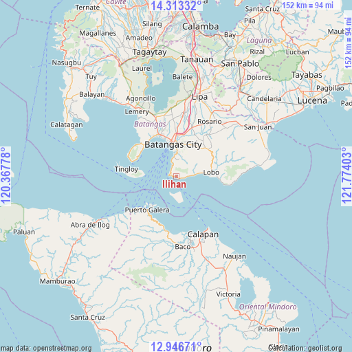
| Upper-left | 14.31332°, | 120.36778° |
| Center: | 13.631°, | 121.0709° |
| Lower-right: | 12.94671°, | 121.77403° |
| Map W x H: | 152×152 km | = 94.4×94.4mi |
| max Lat: | 20.78733° ⇑36.2% North |
| Ilihan: | 13.631° |
| min Lat: | ⇓63.8% South 4.65442° |
| min Long | Ilihan | max Long |
| 117.04868° | 121.0709° | 126.58417° |
| W 25.4%⇐ | ⇒74.6% E |
Elevation
Elevation of Ilihan is 15 m = 49 ft, and this is 72.9 m = 239 ft below average elevation for this country.
| Max E: |
2262 m = 7421 ft | 62.8% |
| Avg. | 87.9 m = 288 ft | |
| Ilihan | 15 m = 49 ft | |
Min E: |
-2 m = -7 ft | 37.2% |
See also: Philippines elevation on elevation.city.
Geographical zone
Ilihan is located in North Torrid zone (between Equator and Tropic of Cancer). Distance of this Northern Tropic circle is 1090.3 km =677.5 mi to North.| Distance of | km | miles | from Ilihan |
|---|---|---|---|
| North Pole | 8491.4 | 5276.3 | to North |
| Arctic Circle | 5885.5 | 3657.1 | to North |
| Tropic Cancer | 1090.3 | 677.5 | to North |
| Equator | 1515.6 | 941.7 | to South |


Nearby cities:
15 places around Ilihan: (largest is in red/bold)
• Banalo
12.1 km =7.5 mi,  81°
81°
• Batangas
14 km =8.7 mi,  354°
354°
• Bauan
19.1 km =11.9 mi,  339°
339°
• Dagatan
18.3 km =11.4 mi,  49°
49°
• Haligue
6.3 km =3.9 mi, 51°
• Lobo
15.3 km =9.5 mi, 82°
• Mapulo
16.6 km =10.3 mi, 47°
• Puerto Galera
19.3 km =12 mi,  221°
221°
• Sabang
17.1 km =10.6 mi, 217°
• Santa Clara
13.7 km =8.5 mi,  355°
355°
• Santa Rita Aplaya
16.1 km =10 mi, 346°
• Santo Niño
8.3 km =5.2 mi,  18°
18°
• Talaga
18.7 km =11.6 mi,  308°
308°
• Talahib Payap
7.8 km =4.8 mi,  64°
64°
• Wawa
12.3 km =7.6 mi, 350°
Sources, notices
• [Note1] Compared only with cities in Philippines existing in our database
• [Src1] Map data: © OpenStreetMap contributors (CC-BY-SA)
• [Src2] Other city data from geonames.org with taken over terms of usage.
• [Src3] Geographical zone / Annual Mean Temperature by Robert A. Rohde @ Wikipedia
