Tumcon Ilawod geodata
Tumcon Ilawod (Western Visayas) is a populated place; located in Philippines in Asia/Manila (GMT+8) time zone. With population of 5,067 people, there are 1273 cities with bigger population in this country. Compared to other cities in Philippines, 57.8% of cities are located further ↑North; 51.8% of cities are located further →East and 67.4% of cities have higher elevation than Tumcon Ilawod. Note1


Tumcon Ilawod GPS coordinates[2]
10° 55' 0.012" North, 122° 40' 0.012" East
| Map corner | latitude | longitude |
|---|---|---|
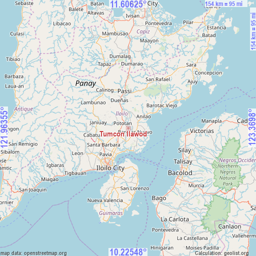
| Upper-left | 11.60625°, | 121.96355° |
| Center: | 10.91667°, | 122.66667° |
| Lower-right: | 10.22548°, | 123.3698° |
| Map W x H: | 153.5×153.5 km | = 95.4×95.4mi |
| max Lat: | 20.78733° ⇑57.8% North |
| Tumcon Ilawod: | 10.91667° |
| min Lat: | ⇓42.2% South 4.65442° |
| min Long | Tumcon Ilawod | max Long |
| 117.04868° | 122.66667° | 126.58417° |
| W 48.2%⇐ | ⇒51.8% E |
Elevation
Elevation of Tumcon Ilawod is 13 m = 43 ft, and this is 74.9 m = 246 ft below average elevation for this country.
| Max E: |
2262 m = 7421 ft | 67.4% |
| Avg. | 87.9 m = 288 ft | |
| Tumcon Ilawod | 13 m = 43 ft | |
Min E: |
-2 m = -7 ft | 32.6% |
See also: Philippines elevation on elevation.city.
Geographical zone
Tumcon Ilawod is located in North Torrid zone (between Equator and Tropic of Cancer). Distance of Equator is 1213.8 km =754.2 mi to South.| Distance of | km | miles | from Tumcon Ilawod |
|---|---|---|---|
| North Pole | 8793.2 | 5463.8 | to North |
| Arctic Circle | 6187.4 | 3844.7 | to North |
| Tropic Cancer | 1392.1 | 865 | to North |
| Equator | 1213.8 | 754.2 | to South |


Nearby cities:
15 places around Tumcon Ilawod: (largest is in red/bold)
• Abangay
5.8 km =3.6 mi,  341°
341°
• Barotac Nuevo
4.8 km =3 mi,  121°
121°
• Bolilao
8.2 km =5.1 mi, 116°
• Cabilauan
2.8 km =1.7 mi,  196°
196°
• Dingle
9.2 km =5.7 mi,  3°
3°
• Ermita
5.8 km =3.6 mi,  108°
108°
• Igang
3 km =1.9 mi,  268°
268°
• Jalaud
8.6 km =5.3 mi, 199°
• Jalaud
9.2 km =5.7 mi, 106°
• Jamabalod
6.5 km =4 mi,  229°
229°
• Lucena
8.7 km =5.4 mi,  241°
241°
• Monpon
3.2 km =2 mi,  260°
260°
• Pototan
4.6 km =2.9 mi,  311°
311°
• Sulangan
10 km =6.2 mi,  165°
165°
• Tiwi
7.5 km =4.7 mi,  78°
78°
Sources, notices
• [Note1] Compared only with cities in Philippines existing in our database
• [Src1] Map data: © OpenStreetMap contributors (CC-BY-SA)
• [Src2] Other city data from geonames.org with taken over terms of usage.
• [Src3] Geographical zone / Annual Mean Temperature by Robert A. Rohde @ Wikipedia
