Jalaud geodata
Jalaud (Western Visayas) is a populated place; located in Philippines in Asia/Manila (GMT+8) time zone. With population of 2,814 people, there are 2768 cities with bigger population in this country. Compared to other cities in Philippines, 58.8% of cities are located further ↑North; 52.3% of cities are located further →East and 92.7% of cities have higher elevation than Jalaud. Note1


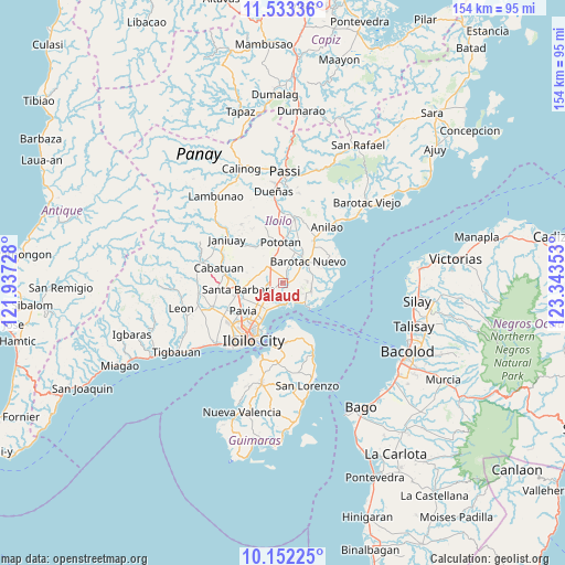
Jalaud GPS coordinates[2]
10° 50' 36.96" North, 122° 38' 25.44" East
| Map corner | latitude | longitude |
|---|---|---|
| Upper-left | 11.53336°, | 121.93728° |
| Center: | 10.8436°, | 122.6404° |
| Lower-right: | 10.15225°, | 123.34353° |
| Map W x H: | 153.6×153.6 km | = 95.4×95.4mi |
| max Lat: | 20.78733° ⇑58.8% North |
| Jalaud: | 10.8436° |
| min Lat: | ⇓41.2% South 4.65442° |
| min Long | Jalaud | max Long |
| 117.04868° | 122.6404° | 126.58417° |
| W 47.7%⇐ | ⇒52.3% E |
Elevation
Elevation of Jalaud is 6 m = 20 ft, and this is 81.9 m = 269 ft below average elevation for this country.
| Max E: |
2262 m = 7421 ft | 92.7% |
| Avg. | 87.9 m = 288 ft | |
| Jalaud | 6 m = 20 ft | |
Min E: |
-2 m = -7 ft | 7.3% |
See also: Philippines elevation on elevation.city.
Geographical zone
Jalaud is located in North Torrid zone (between Equator and Tropic of Cancer). Distance of Equator is 1205.7 km =749.2 mi to South.| Distance of | km | miles | from Jalaud |
|---|---|---|---|
| North Pole | 8801.4 | 5468.9 | to North |
| Arctic Circle | 6195.5 | 3849.7 | to North |
| Tropic Cancer | 1400.2 | 870 | to North |
| Equator | 1205.7 | 749.2 | to South |


Nearby cities:
15 places around Jalaud: (largest is in red/bold)
• Barotac Nuevo
9 km =5.6 mi,  51°
51°
• Cabilauan
5.8 km =3.6 mi,  20°
20°
• Dumangas
8.2 km =5.1 mi,  104°
104°
• Ermita
10.4 km =6.5 mi, 53°
• Igang
8.1 km =5 mi,  358°
358°
• Jamabalod
4.4 km =2.7 mi,  331°
331°
• Kabilauan
7.6 km =4.7 mi,  284°
284°
• Leganes
8.4 km =5.2 mi,  221°
221°
• Lucena
6.2 km =3.9 mi,  309°
309°
• Monpon
7.6 km =4.7 mi, 357°
• Pasil
3.4 km =2.1 mi,  259°
259°
• Sulangan
5.6 km =3.5 mi,  105°
105°
• Tigum
10.5 km =6.5 mi,  230°
230°
• Tumcon Ilawod
8.6 km =5.3 mi, 19°
• Zarraga
4.4 km =2.7 mi, 233°
Sources, notices
• [Note1] Compared only with cities in Philippines existing in our database
• [Src1] Map data: © OpenStreetMap contributors (CC-BY-SA)
• [Src2] Other city data from geonames.org with taken over terms of usage.
• [Src3] Geographical zone / Annual Mean Temperature by Robert A. Rohde @ Wikipedia
