Pototan geodata
Pototan (Western Visayas) is a seat of a third-order administrative division; located in Philippines in Asia/Manila (GMT+8) time zone. With population of 10,195 people, there are 598 cities with bigger population in this country. Compared to other cities in Philippines, 57.4% of cities are located further ↑North; 52.5% of cities are located further →East and 55.6% of cities have lower elevation than Pototan. Note1


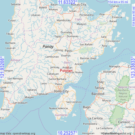
Pototan GPS coordinates[2]
10° 56' 37.32" North, 122° 38' 6.72" East
| Map corner | latitude | longitude |
|---|---|---|
| Upper-left | 11.63322°, | 121.93208° |
| Center: | 10.9437°, | 122.6352° |
| Lower-right: | 10.25257°, | 123.33833° |
| Map W x H: | 153.5×153.5 km | = 95.4×95.4mi |
| max Lat: | 20.78733° ⇑57.4% North |
| Pototan: | 10.9437° |
| min Lat: | ⇓42.6% South 4.65442° |
| min Long | Pototan | max Long |
| 117.04868° | 122.6352° | 126.58417° |
| W 47.5%⇐ | ⇒52.5% E |
Elevation
Elevation of Pototan is 28 m = 92 ft, and this is 59.9 m = 197 ft below average elevation for this country.
| Max E: |
2262 m = 7421 ft | 44.4% |
| Avg. | 87.9 m = 288 ft | |
| Pototan | 28 m = 92 ft | |
Min E: |
-2 m = -7 ft | 55.6% |
See also: Philippines elevation on elevation.city.
Geographical zone
Pototan is located in North Torrid zone (between Equator and Tropic of Cancer). Distance of Equator is 1216.8 km =756.1 mi to South.| Distance of | km | miles | from Pototan |
|---|---|---|---|
| North Pole | 8790.2 | 5462 | to North |
| Arctic Circle | 6184.3 | 3842.7 | to North |
| Tropic Cancer | 1389.1 | 863.1 | to North |
| Equator | 1216.8 | 756.1 | to South |


Nearby cities:
15 places around Pototan: (largest is in red/bold)
• Abangay
3 km =1.9 mi,  32°
32°
• Barotac Nuevo
9.4 km =5.8 mi,  126°
126°
• Cabilauan
6.3 km =3.9 mi,  155°
155°
• Dingle
7.3 km =4.5 mi, 32°
• Ermita
10.1 km =6.3 mi,  118°
118°
• Igang
3.1 km =1.9 mi,  172°
172°
• Jalaud
11.1 km =6.9 mi,  177°
177°
• Jamabalod
7.4 km =4.6 mi,  191°
191°
• Kabilauan
11.4 km =7.1 mi,  216°
216°
• Lucena
8.3 km =5.2 mi,  210°
210°
• Mina
6.8 km =4.2 mi,  258°
258°
• Monpon
3.5 km =2.2 mi, 175°
• Pasil
12.1 km =7.5 mi, 193°
• Tiwi
10.9 km =6.8 mi,  98°
98°
• Tumcon Ilawod
4.6 km =2.9 mi, 131°
Sources, notices
• [Note1] Compared only with cities in Philippines existing in our database
• [Src1] Map data: © OpenStreetMap contributors (CC-BY-SA)
• [Src2] Other city data from geonames.org with taken over terms of usage.
• [Src3] Geographical zone / Annual Mean Temperature by Robert A. Rohde @ Wikipedia
