Paitan geodata
Paitan (Autonomous Region in Muslim Mindanao) is a populated place; located in Philippines in Asia/Manila (GMT+8) time zone. With population of 3,294 people, there are 2224 cities with bigger population in this country. Compared to other cities in Philippines, 94.4% of cities are located further ↑North; 85.7% of cities are located further ←West and 53.1% of cities have higher elevation than Paitan. Note1
Administrative division(s):
- Level 1: Autonomous Region in Muslim Mindanao
- Level 2: Province of Maguindanao
- Level 3: Mangudadatu


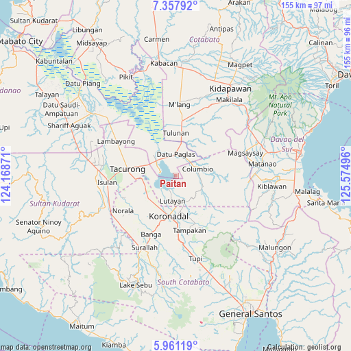
Paitan GPS coordinates[2]
6° 39' 36.18" North, 124° 52' 18.588" East
| Map corner | latitude | longitude |
|---|---|---|
| Upper-left | 7.35792°, | 124.16871° |
| Center: | 6.66005°, | 124.87183° |
| Lower-right: | 5.96119°, | 125.57496° |
| Map W x H: | 155.3×155.3 km | = 96.5×96.5mi |
| max Lat: | 20.78733° ⇑94.4% North |
| Paitan: | 6.66005° |
| min Lat: | ⇓5.6% South 4.65442° |
| min Long | Paitan | max Long |
| 117.04868° | 124.87183° | 126.58417° |
| W 85.7%⇐ | ⇒14.3% E |
Elevation
Elevation of Paitan is 21 m = 69 ft, and this is 66.9 m = 219 ft below average elevation for this country.
| Max E: |
2262 m = 7421 ft | 53.1% |
| Avg. | 87.9 m = 288 ft | |
| Paitan | 21 m = 69 ft | |
Min E: |
-2 m = -7 ft | 46.9% |
See also: Philippines elevation on elevation.city.
Geographical zone
Paitan is located in North Torrid zone (between Equator and Tropic of Cancer). Distance of Equator is 740.5 km =460.1 mi to South.| Distance of | km | miles | from Paitan |
|---|---|---|---|
| North Pole | 9266.5 | 5757.9 | to North |
| Arctic Circle | 6660.6 | 4138.7 | to North |
| Tropic Cancer | 1865.4 | 1159.1 | to North |
| Equator | 740.5 | 460.1 | to South |


Nearby cities:
15 places around Paitan: (largest is in red/bold)
• Bayasong
1.2 km =0.7 mi,  173°
173°
• Blingkong
8.2 km =5.1 mi, 166°
• Buluan
10.2 km =6.3 mi,  310°
310°
• Columbio
8.3 km =5.2 mi,  60°
60°
• Damawato
10.7 km =6.6 mi,  294°
294°
• Datu Paglas
12.1 km =7.5 mi,  348°
348°
• Digal
13.3 km =8.3 mi,  321°
321°
• Lutayan
4.7 km =2.9 mi, 166°
• Maibu
13.2 km =8.2 mi,  220°
220°
• Maindang
8.3 km =5.2 mi,  199°
199°
• New Iloilo
15.4 km =9.6 mi, 216°
• President Quirino
15.6 km =9.7 mi, 288°
• Tamnag
9.7 km =6 mi, 174°
• Tantangan
14.5 km =9 mi,  249°
249°
• Telafas
11.7 km =7.3 mi,  106°
106°
Sources, notices
• [Note1] Compared only with cities in Philippines existing in our database
• [Src1] Map data: © OpenStreetMap contributors (CC-BY-SA)
• [Src2] Other city data from geonames.org with taken over terms of usage.
• [Src3] Geographical zone / Annual Mean Temperature by Robert A. Rohde @ Wikipedia
