Tiparak geodata
Tiparak (Zamboanga Peninsula) is a populated place; located in Philippines in Asia/Manila (GMT+8) time zone. With population of 2,898 people, there are 2648 cities with bigger population in this country. Compared to other cities in Philippines, 82.3% of cities are located further ↑North; 62.8% of cities are located further ←West and 76.6% of cities have higher elevation than Tiparak. Note1
Administrative division(s):
- Level 1: Zamboanga Peninsula
- Level 2: Province of Zamboanga del Sur
- Level 3: Tambulig


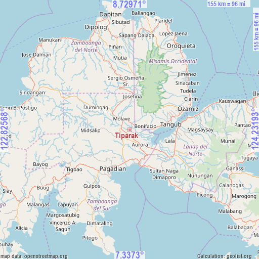
Tiparak GPS coordinates[2]
8° 2' 2.76" North, 123° 31' 43.68" East
| Map corner | latitude | longitude |
|---|---|---|
| Upper-left | 8.72971°, | 122.82568° |
| Center: | 8.0341°, | 123.5288° |
| Lower-right: | 7.3373°, | 124.23193° |
| Map W x H: | 154.8×154.8 km | = 96.2×96.2mi |
| max Lat: | 20.78733° ⇑82.3% North |
| Tiparak: | 8.0341° |
| min Lat: | ⇓17.7% South 4.65442° |
| min Long | Tiparak | max Long |
| 117.04868° | 123.5288° | 126.58417° |
| W 62.8%⇐ | ⇒37.2% E |
Elevation
Elevation of Tiparak is 10 m = 33 ft, and this is 77.9 m = 256 ft below average elevation for this country.
| Max E: |
2262 m = 7421 ft | 76.6% |
| Avg. | 87.9 m = 288 ft | |
| Tiparak | 10 m = 33 ft | |
Min E: |
-2 m = -7 ft | 23.4% |
See also: Philippines elevation on elevation.city.
Geographical zone
Tiparak is located in North Torrid zone (between Equator and Tropic of Cancer). Distance of Equator is 893.3 km =555.1 mi to South.| Distance of | km | miles | from Tiparak |
|---|---|---|---|
| North Pole | 9113.8 | 5663.1 | to North |
| Arctic Circle | 6507.9 | 4043.8 | to North |
| Tropic Cancer | 1712.6 | 1064.2 | to North |
| Equator | 893.3 | 555.1 | to South |


Nearby cities:
15 places around Tiparak: (largest is in red/bold)
• Aurora
11 km =6.8 mi,  147°
147°
• Bonifacio
9.6 km =6 mi,  77°
77°
• Gubaan
7.6 km =4.7 mi, 149°
• Josefina
18.5 km =11.5 mi,  1°
1°
• Labangan
18.8 km =11.7 mi,  185°
185°
• Mahayag
13.1 km =8.1 mi,  315°
315°
• Margos
18.3 km =11.4 mi,  128°
128°
• Molave
7 km =4.3 mi, 323°
• Pangabuan
18.6 km =11.6 mi, 82°
• Ramon Magsaysay
4.2 km =2.6 mi,  210°
210°
• Sergio Osmeña Sr
15.1 km =9.4 mi,  347°
347°
• Sumalig
15.3 km =9.5 mi,  104°
104°
• Taguitic
15.5 km =9.6 mi, 133°
• Tambulig
4.1 km =2.5 mi,  9°
9°
• Tucuran
20.8 km =12.9 mi,  166°
166°
Sources, notices
• [Note1] Compared only with cities in Philippines existing in our database
• [Src1] Map data: © OpenStreetMap contributors (CC-BY-SA)
• [Src2] Other city data from geonames.org with taken over terms of usage.
• [Src3] Geographical zone / Annual Mean Temperature by Robert A. Rohde @ Wikipedia
