Tinogboc geodata
Tinogboc (Western Visayas) is a populated place; located in Philippines in Asia/Manila (GMT+8) time zone. With population of 2,208 people, there are 3873 cities with bigger population in this country. Compared to other cities in Philippines, 51.8% of cities are located further ↓South; 68.3% of cities are located further →East and 89.7% of cities have higher elevation than Tinogboc. Note1


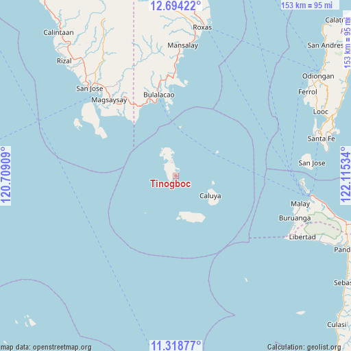
Tinogboc GPS coordinates[2]
12° 0' 26.532" North, 121° 24' 43.956" East
| Map corner | latitude | longitude |
|---|---|---|
| Upper-left | 12.69422°, | 120.70909° |
| Center: | 12.00737°, | 121.41221° |
| Lower-right: | 11.31877°, | 122.11534° |
| Map W x H: | 152.9×152.9 km | = 95×95mi |
| max Lat: | 20.78733° ⇑48.2% North |
| Tinogboc: | 12.00737° |
| min Lat: | ⇓51.8% South 4.65442° |
| min Long | Tinogboc | max Long |
| 117.04868° | 121.41221° | 126.58417° |
| W 31.7%⇐ | ⇒68.3% E |
Elevation
Elevation of Tinogboc is 7 m = 23 ft, and this is 80.9 m = 265 ft below average elevation for this country.
| Max E: |
2262 m = 7421 ft | 89.7% |
| Avg. | 87.9 m = 288 ft | |
| Tinogboc | 7 m = 23 ft | |
Min E: |
-2 m = -7 ft | 10.3% |
See also: Philippines elevation on elevation.city.
Geographical zone
Tinogboc is located in North Torrid zone (between Equator and Tropic of Cancer). Distance of this Northern Tropic circle is 1270.8 km =789.6 mi to North.| Distance of | km | miles | from Tinogboc |
|---|---|---|---|
| North Pole | 8672 | 5388.5 | to North |
| Arctic Circle | 6066.1 | 3769.3 | to North |
| Tropic Cancer | 1270.8 | 789.6 | to North |
| Equator | 1335.1 | 829.6 | to South |


Nearby cities:
15 places around Tinogboc: (largest is in red/bold)
• Alibug
31.8 km =19.8 mi,  320°
320°
• Bulalacao
36.1 km =22.4 mi,  348°
348°
• Buruanga
54.9 km =34.1 mi,  109°
109°
• Caluya
17 km =10.6 mi,  119°
119°
• Caminauit
50.8 km =31.6 mi, 315°
• Jarigue
16.1 km =10 mi,  169°
169°
• Lanas
55.3 km =34.4 mi,  85°
85°
• Magsaysay
46.1 km =28.6 mi, 321°
• Manaul
49.5 km =30.8 mi,  359°
359°
• Mangarine
51.3 km =31.9 mi, 318°
• Mauhao
33.7 km =20.9 mi,  338°
338°
• Paclolo
48.6 km =30.2 mi,  327°
327°
• San Jose
53.6 km =33.3 mi, 315°
• Santa Teresa
42.4 km =26.3 mi,  309°
309°
• Semirara
7.1 km =4.4 mi, 347°
Sources, notices
• [Note1] Compared only with cities in Philippines existing in our database
• [Src1] Map data: © OpenStreetMap contributors (CC-BY-SA)
• [Src2] Other city data from geonames.org with taken over terms of usage.
• [Src3] Geographical zone / Annual Mean Temperature by Robert A. Rohde @ Wikipedia
