Tayabas geodata
Tayabas (Calabarzon) is a populated place; located in Philippines in Asia/Manila (GMT+8) time zone. With population of 37,330 people, there are 230 cities with bigger population in this country. Compared to other cities in Philippines, 69.4% of cities are located further ↓South; 65.5% of cities are located further →East and 88.5% of cities have lower elevation than Tayabas. Note1
Administrative division(s):
- Level 1: Calabarzon
- Level 2: Province of Quezon
- Level 3: City of Tayabas


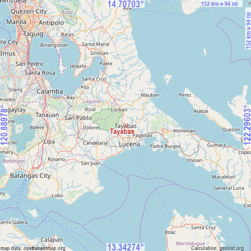
Tayabas GPS coordinates[2]
14° 1' 33.24" North, 121° 35' 34.44" East
| Map corner | latitude | longitude |
|---|---|---|
| Upper-left | 14.70703°, | 120.88978° |
| Center: | 14.0259°, | 121.5929° |
| Lower-right: | 13.34274°, | 122.29603° |
| Map W x H: | 151.7×151.7 km | = 94.3×94.3mi |
| max Lat: | 20.78733° ⇑30.6% North |
| Tayabas: | 14.0259° |
| min Lat: | ⇓69.4% South 4.65442° |
| min Long | Tayabas | max Long |
| 117.04868° | 121.5929° | 126.58417° |
| W 34.5%⇐ | ⇒65.5% E |
Elevation
Elevation of Tayabas is 194 m = 636 ft, and this is 106.1 m = 348 ft above average elevation for this country.
| Max E: |
2262 m = 7421 ft | 11.5% |
| Tayabas | 194 m 636 ft | |
| Avg. | 87.9 m = 288 ft | |
Min E: |
-2 m = -7 ft | 88.5% |
See also: Philippines elevation on elevation.city.
Geographical zone
Tayabas is located in North Torrid zone (between Equator and Tropic of Cancer). Distance of this Northern Tropic circle is 1046.4 km =650.2 mi to North.| Distance of | km | miles | from Tayabas |
|---|---|---|---|
| North Pole | 8447.5 | 5249 | to North |
| Arctic Circle | 5841.6 | 3629.8 | to North |
| Tropic Cancer | 1046.4 | 650.2 | to North |
| Equator | 1559.5 | 969 | to South |


Nearby cities:
15 places around Tayabas: (largest is in red/bold)
• Binahaan
17.8 km =11.1 mi,  102°
102°
• Bukal
14.4 km =8.9 mi,  209°
209°
• Calumpang
6.2 km =3.9 mi,  229°
229°
• Castañas
17.4 km =10.8 mi,  194°
194°
• Concepcion Ibaba
18.3 km =11.4 mi, 231°
• Isabang
8 km =5 mi,  197°
197°
• Janagdong
16.1 km =10 mi, 212°
• Lucban
10.5 km =6.5 mi,  337°
337°
• Lucena
10.8 km =6.7 mi,  165°
165°
• Mamala
8.3 km =5.2 mi,  262°
262°
• Pagbilao
13.1 km =8.1 mi,  119°
119°
• Sampaloc
16 km =9.9 mi,  18°
18°
• Santa Lucia
17.5 km =10.9 mi,  273°
273°
• Sariaya
10.1 km =6.3 mi, 225°
• Talipan
14.2 km =8.8 mi,  136°
136°
Sources, notices
• [Note1] Compared only with cities in Philippines existing in our database
• [Src1] Map data: © OpenStreetMap contributors (CC-BY-SA)
• [Src2] Other city data from geonames.org with taken over terms of usage.
• [Src3] Geographical zone / Annual Mean Temperature by Robert A. Rohde @ Wikipedia
