Isabang geodata
Isabang (Calabarzon) is a populated place; located in Philippines in Asia/Manila (GMT+8) time zone. With population of 3,497 people, there are 2055 cities with bigger population in this country. Compared to other cities in Philippines, 68.5% of cities are located further ↓South; 65.6% of cities are located further →East and 80.9% of cities have lower elevation than Isabang. Note1
Administrative division(s):
- Level 1: Calabarzon
- Level 2: Province of Quezon
- Level 3: City of Tayabas


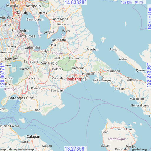
Isabang GPS coordinates[2]
13° 57' 24.984" North, 121° 34' 14.988" East
| Map corner | latitude | longitude |
|---|---|---|
| Upper-left | 14.63828°, | 120.86771° |
| Center: | 13.95694°, | 121.57083° |
| Lower-right: | 13.27358°, | 122.27396° |
| Map W x H: | 151.7×151.7 km | = 94.3×94.3mi |
| max Lat: | 20.78733° ⇑31.5% North |
| Isabang: | 13.95694° |
| min Lat: | ⇓68.5% South 4.65442° |
| min Long | Isabang | max Long |
| 117.04868° | 121.57083° | 126.58417° |
| W 34.4%⇐ | ⇒65.6% E |
Elevation
Elevation of Isabang is 98 m = 322 ft, and this is 10.1 m = 33 ft above average elevation for this country.
| Max E: |
2262 m = 7421 ft | 19.1% |
| Isabang | 98 m 322 ft | |
| Avg. | 87.9 m = 288 ft | |
Min E: |
-2 m = -7 ft | 80.9% |
See also: Philippines elevation on elevation.city.
Geographical zone
Isabang is located in North Torrid zone (between Equator and Tropic of Cancer). Distance of this Northern Tropic circle is 1054.1 km =655 mi to North.| Distance of | km | miles | from Isabang |
|---|---|---|---|
| North Pole | 8455.2 | 5253.8 | to North |
| Arctic Circle | 5849.3 | 3634.6 | to North |
| Tropic Cancer | 1054.1 | 655 | to North |
| Equator | 1551.9 | 964.3 | to South |


Nearby cities:
15 places around Isabang: (largest is in red/bold)
• Bignay Uno
13.6 km =8.5 mi,  221°
221°
• Bukal
6.8 km =4.2 mi, 224°
• Calumpang
4.3 km =2.7 mi,  327°
327°
• Castañas
9.4 km =5.8 mi,  191°
191°
• Concepcion Ibaba
12.4 km =7.7 mi,  252°
252°
• Guisguis
10.8 km =6.7 mi,  211°
211°
• Janagdong
8.6 km =5.3 mi,  226°
226°
• Lucena
5.8 km =3.6 mi,  119°
119°
• Malabanban Norte
15.2 km =9.4 mi,  265°
265°
• Mamala
8.8 km =5.5 mi,  318°
318°
• Montecillo
12.6 km =7.8 mi, 234°
• Pagbilao
13.8 km =8.6 mi,  85°
85°
• Sariaya
4.8 km =3 mi,  277°
277°
• Talipan
12.4 km =7.7 mi,  102°
102°
• Tayabas
8 km =5 mi,  17°
17°
Sources, notices
• [Note1] Compared only with cities in Philippines existing in our database
• [Src1] Map data: © OpenStreetMap contributors (CC-BY-SA)
• [Src2] Other city data from geonames.org with taken over terms of usage.
• [Src3] Geographical zone / Annual Mean Temperature by Robert A. Rohde @ Wikipedia
