Tajao geodata
Tajao (Central Visayas) is a populated place; located in Philippines in Asia/Manila (GMT+8) time zone. With population of 5,394 people, there are 1180 cities with bigger population in this country. Compared to other cities in Philippines, 65% of cities are located further ↑North; 63.7% of cities are located further ←West and 98.1% of cities have higher elevation than Tajao. Note1
Administrative division(s):
- Level 1: Central Visayas
- Level 2: Province of Cebu
- Level 3: Pinamungahan


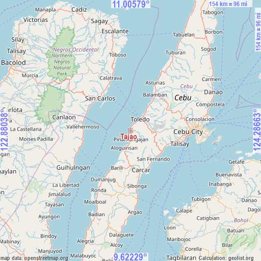
Tajao GPS coordinates[2]
10° 18' 53.28" North, 123° 35' 0.6" East
| Map corner | latitude | longitude |
|---|---|---|
| Upper-left | 11.00579°, | 122.88038° |
| Center: | 10.3148°, | 123.5835° |
| Lower-right: | 9.62229°, | 124.28663° |
| Map W x H: | 153.8×153.8 km | = 95.6×95.6mi |
| max Lat: | 20.78733° ⇑65% North |
| Tajao: | 10.3148° |
| min Lat: | ⇓35% South 4.65442° |
| min Long | Tajao | max Long |
| 117.04868° | 123.5835° | 126.58417° |
| W 63.7%⇐ | ⇒36.3% E |
Elevation
Elevation of Tajao is 3 m = 10 ft, and this is 84.9 m = 279 ft below average elevation for this country.
| Max E: |
2262 m = 7421 ft | 98.1% |
| Avg. | 87.9 m = 288 ft | |
| Tajao | 3 m = 10 ft | |
Min E: |
-2 m = -7 ft | 1.9% |
See also: Philippines elevation on elevation.city.
Geographical zone
Tajao is located in North Torrid zone (between Equator and Tropic of Cancer). Distance of Equator is 1146.9 km =712.7 mi to South.| Distance of | km | miles | from Tajao |
|---|---|---|---|
| North Pole | 8860.2 | 5505.5 | to North |
| Arctic Circle | 6254.3 | 3886.2 | to North |
| Tropic Cancer | 1459 | 906.6 | to North |
| Equator | 1146.9 | 712.7 | to South |


Nearby cities:
15 places around Tajao: (largest is in red/bold)
• Aloguinsan
11 km =6.8 mi,  200°
200°
• Alpaco
13.4 km =8.3 mi,  126°
126°
• Bairan
20.4 km =12.7 mi, 129°
• Bonbon
10.4 km =6.5 mi, 195°
• Buenavista
15.4 km =9.6 mi,  172°
172°
• Cantao-an
19.9 km =12.4 mi,  113°
113°
• Cogon
19.9 km =12.4 mi, 105°
• Lanas
17.2 km =10.7 mi, 108°
• Lut-od
8.1 km =5 mi,  141°
141°
• Pangdan
19.3 km =12 mi,  118°
118°
• Pinamungahan
4.9 km =3 mi,  179°
179°
• Toledo
9.2 km =5.7 mi,  40°
40°
• Tutay
7.6 km =4.7 mi, 182°
• Uling
14.4 km =8.9 mi, 105°
• Valencia
20.1 km =12.5 mi, 170°
Sources, notices
• [Note1] Compared only with cities in Philippines existing in our database
• [Src1] Map data: © OpenStreetMap contributors (CC-BY-SA)
• [Src2] Other city data from geonames.org with taken over terms of usage.
• [Src3] Geographical zone / Annual Mean Temperature by Robert A. Rohde @ Wikipedia
