Igpit geodata
Igpit (Northern Mindanao) is a populated place; located in Philippines in Asia/Manila (GMT+8) time zone. With population of 5,753 people, there are 1105 cities with bigger population in this country. Compared to other cities in Philippines, 78.6% of cities are located further ↑North; 80.5% of cities are located further ←West and 97.1% of cities have higher elevation than Igpit. Note1
Administrative division(s):
- Level 1: Northern Mindanao
- Level 2: Province of Misamis Oriental
- Level 3: Opol


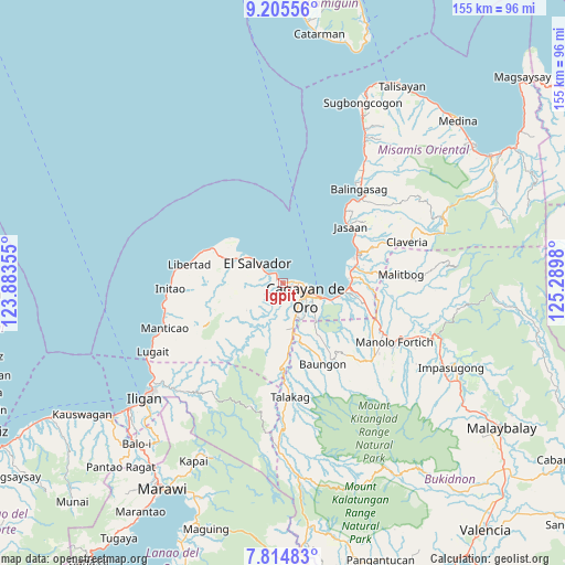
Igpit GPS coordinates[2]
8° 30' 38.988" North, 124° 35' 12.012" East
| Map corner | latitude | longitude |
|---|---|---|
| Upper-left | 9.20556°, | 123.88355° |
| Center: | 8.51083°, | 124.58667° |
| Lower-right: | 7.81483°, | 125.2898° |
| Map W x H: | 154.6×154.6 km | = 96.1×96.1mi |
| max Lat: | 20.78733° ⇑78.6% North |
| Igpit: | 8.51083° |
| min Lat: | ⇓21.4% South 4.65442° |
| min Long | Igpit | max Long |
| 117.04868° | 124.58667° | 126.58417° |
| W 80.5%⇐ | ⇒19.5% E |
Elevation
Elevation of Igpit is 4 m = 13 ft, and this is 83.9 m = 275 ft below average elevation for this country.
| Max E: |
2262 m = 7421 ft | 97.1% |
| Avg. | 87.9 m = 288 ft | |
| Igpit | 4 m = 13 ft | |
Min E: |
-2 m = -7 ft | 2.9% |
See also: Philippines elevation on elevation.city.
Geographical zone
Igpit is located in North Torrid zone (between Equator and Tropic of Cancer). Distance of Equator is 946.3 km =588 mi to South.| Distance of | km | miles | from Igpit |
|---|---|---|---|
| North Pole | 9060.7 | 5630.1 | to North |
| Arctic Circle | 6454.9 | 4010.9 | to North |
| Tropic Cancer | 1659.6 | 1031.2 | to North |
| Equator | 946.3 | 588 | to South |


Nearby cities:
15 places around Igpit: (largest is in red/bold)
• Agusan
16.7 km =10.4 mi,  97°
97°
• Alubijid
14.2 km =8.8 mi,  299°
299°
• Baikingon
5.6 km =3.5 mi,  220°
220°
• Barra
2 km =1.2 mi,  91°
91°
• Bolo Bolo
8.2 km =5.1 mi,  310°
310°
• Cagayan de Oro
7.4 km =4.6 mi,  115°
115°
• El Salvador
9.1 km =5.7 mi, 309°
• Lagindingan
17.4 km =10.8 mi,  294°
294°
• Lourdes
17.1 km =10.6 mi,  275°
275°
• Lumbia
12.8 km =8 mi,  176°
176°
• Molugan
4 km =2.5 mi,  317°
317°
• Moog
16.7 km =10.4 mi, 307°
• Opol
2.1 km =1.3 mi, 304°
• Taypano
15.9 km =9.9 mi,  190°
190°
• Taytay
6.2 km =3.9 mi, 303°
Sources, notices
• [Note1] Compared only with cities in Philippines existing in our database
• [Src1] Map data: © OpenStreetMap contributors (CC-BY-SA)
• [Src2] Other city data from geonames.org with taken over terms of usage.
• [Src3] Geographical zone / Annual Mean Temperature by Robert A. Rohde @ Wikipedia
