Sinayawan geodata
Sinayawan (Davao) is a populated place; located in Philippines in Asia/Manila (GMT+8) time zone. With population of 4,930 people, there are 1321 cities with bigger population in this country. Compared to other cities in Philippines, 93.8% of cities are located further ↑North; 91.5% of cities are located further ←West and 67.4% of cities have higher elevation than Sinayawan. Note1


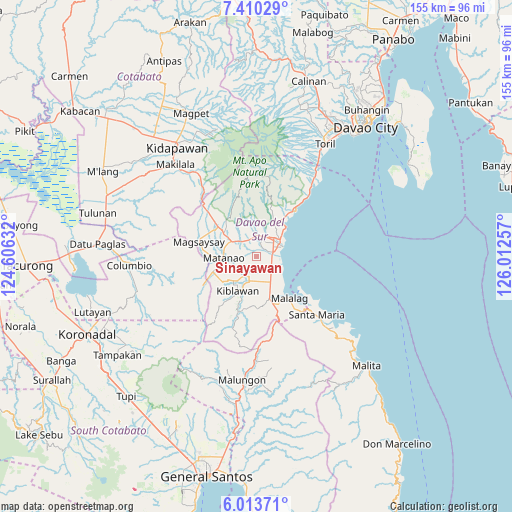
Sinayawan GPS coordinates[2]
6° 42' 45" North, 125° 18' 33.984" East
| Map corner | latitude | longitude |
|---|---|---|
| Upper-left | 7.41029°, | 124.60632° |
| Center: | 6.7125°, | 125.30944° |
| Lower-right: | 6.01371°, | 126.01257° |
| Map W x H: | 155.3×155.3 km | = 96.5×96.5mi |
| max Lat: | 20.78733° ⇑93.8% North |
| Sinayawan: | 6.7125° |
| min Lat: | ⇓6.2% South 4.65442° |
| min Long | Sinayawan | max Long |
| 117.04868° | 125.30944° | 126.58417° |
| W 91.5%⇐ | ⇒8.5% E |
Elevation
Elevation of Sinayawan is 13 m = 43 ft, and this is 74.9 m = 246 ft below average elevation for this country.
| Max E: |
2262 m = 7421 ft | 67.4% |
| Avg. | 87.9 m = 288 ft | |
| Sinayawan | 13 m = 43 ft | |
Min E: |
-2 m = -7 ft | 32.6% |
See also: Philippines elevation on elevation.city.
Geographical zone
Sinayawan is located in North Torrid zone (between Equator and Tropic of Cancer). Distance of Equator is 746.4 km =463.8 mi to South.| Distance of | km | miles | from Sinayawan |
|---|---|---|---|
| North Pole | 9260.7 | 5754.3 | to North |
| Arctic Circle | 6654.8 | 4135.1 | to North |
| Tropic Cancer | 1859.6 | 1155.5 | to North |
| Equator | 746.4 | 463.8 | to South |


Nearby cities:
15 places around Sinayawan: (largest is in red/bold)
• Balutakay
4.8 km =3 mi,  78°
78°
• Bansalan
13.4 km =8.3 mi,  307°
307°
• Digos
6.7 km =4.2 mi,  51°
51°
• Goma
8.9 km =5.5 mi,  8°
8°
• Guihing Proper
5.7 km =3.5 mi,  123°
123°
• Hagonoy
3.7 km =2.3 mi,  151°
151°
• Ignit
2.3 km =1.4 mi,  236°
236°
• Kiblawan
13.6 km =8.5 mi,  216°
216°
• Malinao
6.4 km =4 mi,  202°
202°
• Managa
5.9 km =3.7 mi, 309°
• Matanao
7.1 km =4.4 mi, 238°
• Matti
6.5 km =4 mi,  359°
359°
• Padada
8.9 km =5.5 mi, 153°
• Sinawilan
8.4 km =5.2 mi,  303°
303°
• Sulop
13.2 km =8.2 mi,  163°
163°
Sources, notices
• [Note1] Compared only with cities in Philippines existing in our database
• [Src1] Map data: © OpenStreetMap contributors (CC-BY-SA)
• [Src2] Other city data from geonames.org with taken over terms of usage.
• [Src3] Geographical zone / Annual Mean Temperature by Robert A. Rohde @ Wikipedia
