Guihing Proper geodata
Guihing Proper (Davao) is a populated place; located in Philippines in Asia/Manila (GMT+8) time zone. With population of 12,466 people, there are 507 cities with bigger population in this country. Compared to other cities in Philippines, 94.2% of cities are located further ↑North; 91.7% of cities are located further ←West and 67.4% of cities have higher elevation than Guihing Proper. Note1


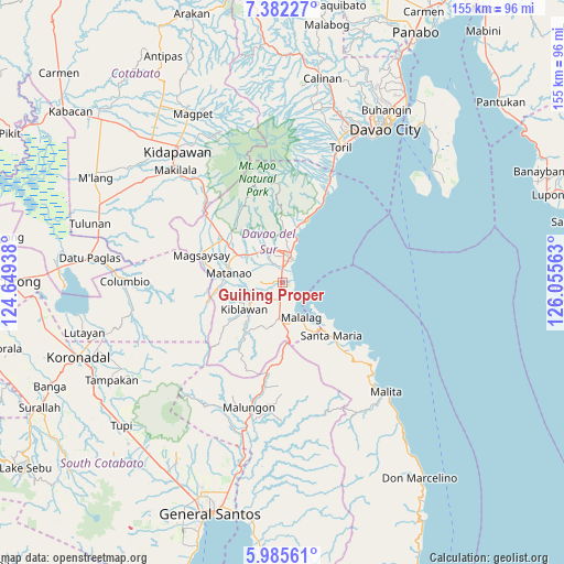
Guihing Proper GPS coordinates[2]
6° 41' 3.984" North, 125° 21' 9" East
| Map corner | latitude | longitude |
|---|---|---|
| Upper-left | 7.38227°, | 124.64938° |
| Center: | 6.68444°, | 125.3525° |
| Lower-right: | 5.98561°, | 126.05563° |
| Map W x H: | 155.3×155.3 km | = 96.5×96.5mi |
| max Lat: | 20.78733° ⇑94.2% North |
| Guihing Proper: | 6.68444° |
| min Lat: | ⇓5.8% South 4.65442° |
| min Long | Guihing Proper | max Long |
| 117.04868° | 125.3525° | 126.58417° |
| W 91.7%⇐ | ⇒8.3% E |
Elevation
Elevation of Guihing Proper is 13 m = 43 ft, and this is 74.9 m = 246 ft below average elevation for this country.
| Max E: |
2262 m = 7421 ft | 67.4% |
| Avg. | 87.9 m = 288 ft | |
| Guihing Proper | 13 m = 43 ft | |
Min E: |
-2 m = -7 ft | 32.6% |
See also: Philippines elevation on elevation.city.
Geographical zone
Guihing Proper is located in North Torrid zone (between Equator and Tropic of Cancer). Distance of Equator is 743.2 km =461.8 mi to South.| Distance of | km | miles | from Guihing Proper |
|---|---|---|---|
| North Pole | 9263.8 | 5756.3 | to North |
| Arctic Circle | 6657.9 | 4137 | to North |
| Tropic Cancer | 1862.7 | 1157.4 | to North |
| Equator | 743.2 | 461.8 | to South |


Nearby cities:
15 places around Guihing Proper: (largest is in red/bold)
• Balutakay
4.1 km =2.5 mi,  358°
358°
• Digos
7.3 km =4.5 mi,  4°
4°
• Goma
12.5 km =7.8 mi,  343°
343°
• Hagonoy
3 km =1.9 mi,  267°
267°
• Ignit
6.9 km =4.3 mi,  285°
285°
• Malalag
11.1 km =6.9 mi,  152°
152°
• Malinao
7.8 km =4.8 mi,  248°
248°
• Managa
11.6 km =7.2 mi,  306°
306°
• Matanao
10.8 km =6.7 mi, 266°
• Matti
10.7 km =6.6 mi,  333°
333°
• New Baclayon
11.3 km =7 mi,  170°
170°
• Padada
4.9 km =3 mi,  189°
189°
• Sinayawan
5.7 km =3.5 mi,  303°
303°
• Sulop
9.6 km =6 mi, 185°
• Tanlad
13.7 km =8.5 mi,  131°
131°
Sources, notices
• [Note1] Compared only with cities in Philippines existing in our database
• [Src1] Map data: © OpenStreetMap contributors (CC-BY-SA)
• [Src2] Other city data from geonames.org with taken over terms of usage.
• [Src3] Geographical zone / Annual Mean Temperature by Robert A. Rohde @ Wikipedia
