Ignit geodata
Ignit (Davao) is a populated place; located in Philippines in Asia/Manila (GMT+8) time zone. With population of 3,238 people, there are 2270 cities with bigger population in this country. Compared to other cities in Philippines, 94% of cities are located further ↑North; 91.3% of cities are located further ←West and 60.8% of cities have higher elevation than Ignit. Note1


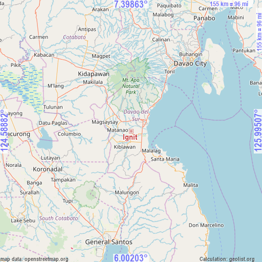
Ignit GPS coordinates[2]
6° 42' 2.988" North, 125° 17' 30.984" East
| Map corner | latitude | longitude |
|---|---|---|
| Upper-left | 7.39863°, | 124.58882° |
| Center: | 6.70083°, | 125.29194° |
| Lower-right: | 6.00203°, | 125.99507° |
| Map W x H: | 155.3×155.3 km | = 96.5×96.5mi |
| max Lat: | 20.78733° ⇑94% North |
| Ignit: | 6.70083° |
| min Lat: | ⇓6% South 4.65442° |
| min Long | Ignit | max Long |
| 117.04868° | 125.29194° | 126.58417° |
| W 91.3%⇐ | ⇒8.7% E |
Elevation
Elevation of Ignit is 16 m = 52 ft, and this is 71.9 m = 236 ft below average elevation for this country.
| Max E: |
2262 m = 7421 ft | 60.8% |
| Avg. | 87.9 m = 288 ft | |
| Ignit | 16 m = 52 ft | |
Min E: |
-2 m = -7 ft | 39.2% |
See also: Philippines elevation on elevation.city.
Geographical zone
Ignit is located in North Torrid zone (between Equator and Tropic of Cancer). Distance of Equator is 745.1 km =463 mi to South.| Distance of | km | miles | from Ignit |
|---|---|---|---|
| North Pole | 9262 | 5755.1 | to North |
| Arctic Circle | 6656.1 | 4135.9 | to North |
| Tropic Cancer | 1860.9 | 1156.3 | to North |
| Equator | 745.1 | 463 | to South |


Nearby cities:
15 places around Ignit: (largest is in red/bold)
• Balutakay
7 km =4.3 mi,  71°
71°
• Bansalan
12.9 km =8 mi,  317°
317°
• Digos
9 km =5.6 mi,  52°
52°
• Goma
10.6 km =6.6 mi,  17°
17°
• Guihing Proper
6.9 km =4.3 mi,  105°
105°
• Hagonoy
4.2 km =2.6 mi,  117°
117°
• Kiblawan
11.4 km =7.1 mi,  212°
212°
• Malinao
4.7 km =2.9 mi,  187°
187°
• Managa
5.7 km =3.5 mi,  332°
332°
• Matanao
4.7 km =2.9 mi,  239°
239°
• Matti
8 km =5 mi,  13°
13°
• Padada
8.9 km =5.5 mi,  138°
138°
• Sinawilan
7.8 km =4.8 mi, 319°
• Sinayawan
2.3 km =1.4 mi,  56°
56°
• Sulop
12.7 km =7.9 mi,  153°
153°
Sources, notices
• [Note1] Compared only with cities in Philippines existing in our database
• [Src1] Map data: © OpenStreetMap contributors (CC-BY-SA)
• [Src2] Other city data from geonames.org with taken over terms of usage.
• [Src3] Geographical zone / Annual Mean Temperature by Robert A. Rohde @ Wikipedia
