Digos geodata
Digos (Davao) is a seat of a third-order administrative division; located in Philippines in Asia/Manila (GMT+8) time zone. With population of 116,122 people, there are 81 cities with bigger population in this country. Compared to other cities in Philippines, 93.5% of cities are located further ↑North; 91.8% of cities are located further ←West and 57.6% of cities have higher elevation than Digos. Note1
Administrative division(s):
- Level 1: Davao
- Level 2: Province of Davao del Sur
- Level 3: City of Digos


Digos GPS coordinates[2]
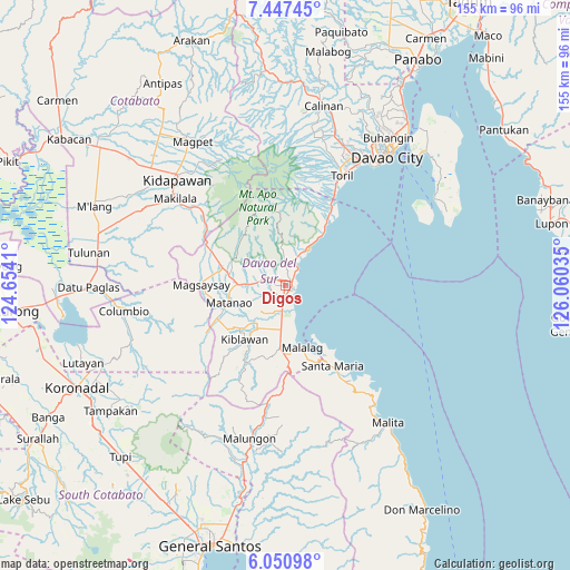
6° 44' 58.992" North, 125° 21' 25.992" East
| Map corner | latitude | longitude |
|---|---|---|
| Upper-left | 7.44745°, | 124.6541° |
| Center: | 6.74972°, | 125.35722° |
| Lower-right: | 6.05098°, | 126.06035° |
| Map W x H: | 155.3×155.3 km | = 96.5×96.5mi |
| max Lat: | 20.78733° ⇑93.5% North |
| Digos: | 6.74972° |
| min Lat: | ⇓6.5% South 4.65442° |
| min Long | Digos | max Long |
| 117.04868° | 125.35722° | 126.58417° |
| W 91.8%⇐ | ⇒8.2% E |
Elevation
Elevation of Digos is 18 m = 59 ft, and this is 69.9 m = 229 ft below average elevation for this country.
| Max E: |
2262 m = 7421 ft | 57.6% |
| Avg. | 87.9 m = 288 ft | |
| Digos | 18 m = 59 ft | |
Min E: |
-2 m = -7 ft | 42.4% |
See also: Digos elevation on elevation.city.
Geographical zone
Digos is located in North Torrid zone (between Equator and Tropic of Cancer). Distance of Equator is 750.5 km =466.3 mi to South.| Distance of | km | miles | from Digos |
|---|---|---|---|
| North Pole | 9256.6 | 5751.8 | to North |
| Arctic Circle | 6650.7 | 4132.6 | to North |
| Tropic Cancer | 1855.4 | 1152.9 | to North |
| Equator | 750.5 | 466.3 | to South |


Nearby cities:
15 places around Digos: (largest is in red/bold)
• Balutakay
3.2 km =2 mi,  190°
190°
• Goma
6.2 km =3.9 mi,  319°
319°
• Guihing Proper
7.3 km =4.5 mi,  184°
184°
• Hagonoy
8.2 km =5.1 mi,  205°
205°
• Ignit
9 km =5.6 mi,  232°
232°
• Malinao
12.7 km =7.9 mi,  217°
217°
• Managa
9.9 km =6.2 mi,  267°
267°
• Matanao
13.7 km =8.5 mi,  235°
235°
• Matti
5.8 km =3.6 mi,  293°
293°
• Padada
12.2 km =7.6 mi, 186°
• Santa Cruz
11.5 km =7.1 mi,  32°
32°
• Sinawilan
12.2 km =7.6 mi, 272°
• Sinayawan
6.7 km =4.2 mi, 231°
• Takub
13.9 km =8.6 mi, 31°
• Tuban
8.8 km =5.5 mi,  21°
21°
Sources, notices
• [Note1] Compared only with cities in Philippines existing in our database
• [Src1] Map data: © OpenStreetMap contributors (CC-BY-SA)
• [Src2] Other city data from geonames.org with taken over terms of usage.
• [Src3] Geographical zone / Annual Mean Temperature by Robert A. Rohde @ Wikipedia
