Sinamar geodata
Sinamar (Cagayan Valley) is a populated place; located in Philippines in Asia/Manila (GMT+8) time zone. With population of 6,012 people, there are 1040 cities with bigger population in this country. Compared to other cities in Philippines, 92.9% of cities are located further ↓South; 65.7% of cities are located further →East and 78.5% of cities have lower elevation than Sinamar. Note1


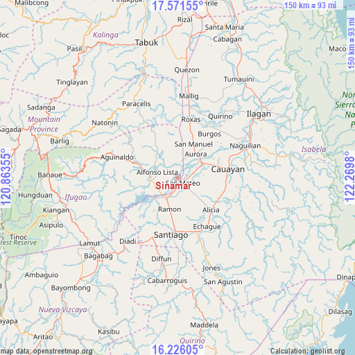
Sinamar GPS coordinates[2]
16° 54' 0" North, 121° 34' 0.012" East
| Map corner | latitude | longitude |
|---|---|---|
| Upper-left | 17.57155°, | 120.86355° |
| Center: | 16.9°, | 121.56667° |
| Lower-right: | 16.22605°, | 122.2698° |
| Map W x H: | 149.6×149.6 km | = 93×93mi |
| max Lat: | 20.78733° ⇑7.1% North |
| Sinamar: | 16.9° |
| min Lat: | ⇓92.9% South 4.65442° |
| min Long | Sinamar | max Long |
| 117.04868° | 121.56667° | 126.58417° |
| W 34.3%⇐ | ⇒65.7% E |
Elevation
Elevation of Sinamar is 82 m = 269 ft, and this is 5.9 m = 19 ft below average elevation for this country.
| Max E: |
2262 m = 7421 ft | 21.5% |
| Avg. | 87.9 m = 288 ft | |
| Sinamar | 82 m = 269 ft | |
Min E: |
-2 m = -7 ft | 78.5% |
See also: Philippines elevation on elevation.city.
Geographical zone
Sinamar is located in North Torrid zone (between Equator and Tropic of Cancer). Distance of this Northern Tropic circle is 726.8 km =451.6 mi to North.| Distance of | km | miles | from Sinamar |
|---|---|---|---|
| North Pole | 8128 | 5050.5 | to North |
| Arctic Circle | 5522.1 | 3431.3 | to North |
| Tropic Cancer | 726.8 | 451.6 | to North |
| Equator | 1879.1 | 1167.6 | to South |


Nearby cities:
15 places around Sinamar: (largest is in red/bold)
• Aurora
12.5 km =7.8 mi,  36°
36°
• Bagong Tanza
10.3 km =6.4 mi,  27°
27°
• Cabatuan
12.5 km =7.8 mi,  59°
59°
• Diamantina
6.7 km =4.2 mi,  72°
72°
• Eden
15.7 km =9.8 mi,  12°
12°
• Esperanza East
18.5 km =11.5 mi, 42°
• La Paz
10.9 km =6.8 mi,  83°
83°
• Magdalena
12 km =7.5 mi, 61°
• Nagrumbuan
15.2 km =9.4 mi,  90°
90°
• Pinoma
15.2 km =9.4 mi,  100°
100°
• Potia
10.5 km =6.5 mi,  237°
237°
• Ramon
13.3 km =8.3 mi,  194°
194°
• Salinungan Proper
6.1 km =3.8 mi,  124°
124°
• San Manuel
15.6 km =9.7 mi, 28°
• San Mateo
2.9 km =1.8 mi,  132°
132°
Sources, notices
• [Note1] Compared only with cities in Philippines existing in our database
• [Src1] Map data: © OpenStreetMap contributors (CC-BY-SA)
• [Src2] Other city data from geonames.org with taken over terms of usage.
• [Src3] Geographical zone / Annual Mean Temperature by Robert A. Rohde @ Wikipedia
