Potia geodata
Potia (Cordillera) is a seat of a third-order administrative division; located in Philippines in Asia/Manila (GMT+8) time zone. In our database, there are 4166 cities with bigger population. Compared to other cities in Philippines, 92.6% of cities are located further ↓South; 66.8% of cities are located further →East and 87.3% of cities have lower elevation than Potia. Note1
Administrative division(s):
- Level 1: Cordillera
- Level 2: Province of Ifugao
- Level 3: Alfonso Lista (Potia)


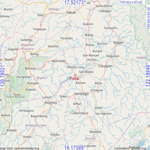
Potia GPS coordinates[2]
16° 51' 0" North, 121° 28' 59.988" East
| Map corner | latitude | longitude |
|---|---|---|
| Upper-left | 17.52173°, | 120.78021° |
| Center: | 16.85°, | 121.48333° |
| Lower-right: | 16.17588°, | 122.18646° |
| Map W x H: | 149.6×149.6 km | = 93×93mi |
| max Lat: | 20.78733° ⇑7.4% North |
| Potia: | 16.85° |
| min Lat: | ⇓92.6% South 4.65442° |
| min Long | Potia | max Long |
| 117.04868° | 121.48333° | 126.58417° |
| W 33.2%⇐ | ⇒66.8% E |
Elevation
Elevation of Potia is 171 m = 561 ft, and this is 83.1 m = 273 ft above average elevation for this country.
| Max E: |
2262 m = 7421 ft | 12.7% |
| Potia | 171 m 561 ft | |
| Avg. | 87.9 m = 288 ft | |
Min E: |
-2 m = -7 ft | 87.3% |
See also: Philippines elevation on elevation.city.
Geographical zone
Potia is located in North Torrid zone (between Equator and Tropic of Cancer). Distance of this Northern Tropic circle is 732.4 km =455.1 mi to North.| Distance of | km | miles | from Potia |
|---|---|---|---|
| North Pole | 8133.5 | 5053.9 | to North |
| Arctic Circle | 5527.6 | 3434.7 | to North |
| Tropic Cancer | 732.4 | 455.1 | to North |
| Equator | 1873.5 | 1164.1 | to South |


Nearby cities:
15 places around Potia: (largest is in red/bold)
• Bagong Tanza
20.1 km =12.5 mi,  42°
42°
• Batal
22 km =13.7 mi,  145°
145°
• Cabulay
11.7 km =7.3 mi,  172°
172°
• Cordon
19.6 km =12.2 mi,  185°
185°
• Diadi
19.1 km =11.9 mi,  223°
223°
• Diamantina
17 km =10.6 mi,  63°
63°
• La Paz
20.8 km =12.9 mi,  71°
71°
• Ramon
9.2 km =5.7 mi,  143°
143°
• Ramos West
21.8 km =13.5 mi, 140°
• Rizal
16.5 km =10.3 mi, 152°
• Salinungan Proper
14.1 km =8.8 mi,  81°
81°
• San Isidro
19.2 km =11.9 mi,  132°
132°
• San Mateo
11.6 km =7.2 mi, 72°
• Santiago
19.3 km =12 mi,  158°
158°
• Sinamar
10.5 km =6.5 mi, 57°
Sources, notices
• [Note1] Compared only with cities in Philippines existing in our database
• [Src1] Map data: © OpenStreetMap contributors (CC-BY-SA)
• [Src2] Other city data from geonames.org with taken over terms of usage.
• [Src3] Geographical zone / Annual Mean Temperature by Robert A. Rohde @ Wikipedia
