Sigay geodata
Sigay (Ilocos) is a seat of a third-order administrative division; located in Philippines in Asia/Manila (GMT+8) time zone. With population of 2,419 people, there are 3430 cities with bigger population in this country. Compared to other cities in Philippines, 94% of cities are located further ↓South; 88% of cities are located further →East and 95.7% of cities have lower elevation than Sigay. Note1


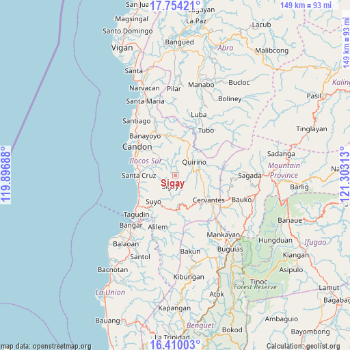
Sigay GPS coordinates[2]
17° 4' 59.988" North, 120° 36' 0" East
| Map corner | latitude | longitude |
|---|---|---|
| Upper-left | 17.75421°, | 119.89688° |
| Center: | 17.08333°, | 120.6° |
| Lower-right: | 16.41003°, | 121.30313° |
| Map W x H: | 149.5×149.5 km | = 92.9×92.9mi |
| max Lat: | 20.78733° ⇑6% North |
| Sigay: | 17.08333° |
| min Lat: | ⇓94% South 4.65442° |
| min Long | Sigay | max Long |
| 117.04868° | 120.6° | 126.58417° |
| W 12%⇐ | ⇒88% E |
Elevation
Elevation of Sigay is 470 m = 1542 ft, and this is 382.1 m = 1254 ft above average elevation for this country.
| Max E: |
2262 m = 7421 ft | 4.3% |
| Sigay | 470 m 1542 ft | |
| Avg. | 87.9 m = 288 ft | |
Min E: |
-2 m = -7 ft | 95.7% |
See also: Philippines elevation on elevation.city.
Geographical zone
Sigay is located in North Torrid zone (between Equator and Tropic of Cancer). Distance of this Northern Tropic circle is 706.4 km =438.9 mi to North.| Distance of | km | miles | from Sigay |
|---|---|---|---|
| North Pole | 8107.6 | 5037.8 | to North |
| Arctic Circle | 5501.7 | 3418.6 | to North |
| Tropic Cancer | 706.4 | 438.9 | to North |
| Equator | 1899.5 | 1180.3 | to South |


Nearby cities:
15 places around Sigay: (largest is in red/bold)
• Allangigan Primero
15.3 km =9.5 mi,  311°
311°
• Banayoyo
20.8 km =12.9 mi,  323°
323°
• Calongbuyan
20.5 km =12.7 mi,  296°
296°
• Candon
20 km =12.4 mi, 308°
• Cervantes
17.7 km =11 mi,  125°
125°
• Comillas Norte
20.9 km =13 mi, 131°
• Galimuyod
17.7 km =11 mi, 309°
• Gregorio del Pilar
5.4 km =3.4 mi,  13°
13°
• Parioc Segundo
17.5 km =10.9 mi, 305°
• Quirino
10.9 km =6.8 mi,  42°
42°
• Salcedo
10.2 km =6.3 mi, 320°
• San Emilio
15.9 km =9.9 mi,  4°
4°
• Santa Cruz
15.7 km =9.8 mi,  270°
270°
• Santa Lucia
16.1 km =10 mi,  283°
283°
• Suyo
14.3 km =8.9 mi,  213°
213°
Sources, notices
• [Note1] Compared only with cities in Philippines existing in our database
• [Src1] Map data: © OpenStreetMap contributors (CC-BY-SA)
• [Src2] Other city data from geonames.org with taken over terms of usage.
• [Src3] Geographical zone / Annual Mean Temperature by Robert A. Rohde @ Wikipedia
