Sibaguan geodata
Sibaguan (Western Visayas) is a populated place; located in Philippines in Asia/Manila (GMT+8) time zone. With population of 2,174 people, there are 3939 cities with bigger population in this country. Compared to other cities in Philippines, 50.8% of cities are located further ↑North; 51.2% of cities are located further →East and 97.1% of cities have higher elevation than Sibaguan. Note1


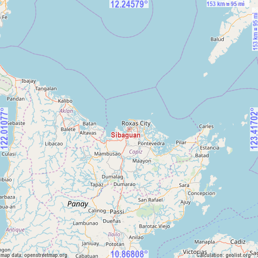
Sibaguan GPS coordinates[2]
11° 33' 28.008" North, 122° 42' 50.004" East
| Map corner | latitude | longitude |
|---|---|---|
| Upper-left | 12.24579°, | 122.01077° |
| Center: | 11.55778°, | 122.71389° |
| Lower-right: | 10.86808°, | 123.41702° |
| Map W x H: | 153.2×153.2 km | = 95.2×95.2mi |
| max Lat: | 20.78733° ⇑50.8% North |
| Sibaguan: | 11.55778° |
| min Lat: | ⇓49.2% South 4.65442° |
| min Long | Sibaguan | max Long |
| 117.04868° | 122.71389° | 126.58417° |
| W 48.8%⇐ | ⇒51.2% E |
Elevation
Elevation of Sibaguan is 4 m = 13 ft, and this is 83.9 m = 275 ft below average elevation for this country.
| Max E: |
2262 m = 7421 ft | 97.1% |
| Avg. | 87.9 m = 288 ft | |
| Sibaguan | 4 m = 13 ft | |
Min E: |
-2 m = -7 ft | 2.9% |
See also: Philippines elevation on elevation.city.
Geographical zone
Sibaguan is located in North Torrid zone (between Equator and Tropic of Cancer). Distance of Equator is 1285.1 km =798.5 mi to South.| Distance of | km | miles | from Sibaguan |
|---|---|---|---|
| North Pole | 8722 | 5419.6 | to North |
| Arctic Circle | 6116.1 | 3800.4 | to North |
| Tropic Cancer | 1320.8 | 820.7 | to North |
| Equator | 1285.1 | 798.5 | to South |


Nearby cities:
15 places around Sibaguan: (largest is in red/bold)
• Basiao
8.4 km =5.2 mi,  263°
263°
• Bolo
5.1 km =3.2 mi,  112°
112°
• Intampilan
9.1 km =5.7 mi,  159°
159°
• Ivisan
4.7 km =2.9 mi,  212°
212°
• Lanot
6.4 km =4 mi,  132°
132°
• Lono
5.2 km =3.2 mi, 160°
• Malocloc
7 km =4.3 mi, 213°
• Mianay
9.7 km =6 mi,  188°
188°
• Panay
8.7 km =5.4 mi,  90°
90°
• Parion
9.4 km =5.8 mi, 191°
• Pawa
11.3 km =7 mi, 87°
• Roxas City
5.1 km =3.2 mi,  52°
52°
• Talon
3.6 km =2.2 mi,  273°
273°
• Tanza
8.1 km =5 mi,  70°
70°
• Timpas
9 km =5.6 mi,  167°
167°
Sources, notices
• [Note1] Compared only with cities in Philippines existing in our database
• [Src1] Map data: © OpenStreetMap contributors (CC-BY-SA)
• [Src2] Other city data from geonames.org with taken over terms of usage.
• [Src3] Geographical zone / Annual Mean Temperature by Robert A. Rohde @ Wikipedia
