Santa Teresita geodata
Santa Teresita (Calabarzon) is a seat of a third-order administrative division; located in Philippines in Asia/Manila (GMT+8) time zone. With population of 2,849 people, there are 2704 cities with bigger population in this country. Compared to other cities in Philippines, 66.7% of cities are located further ↓South; 76.8% of cities are located further →East and 87.7% of cities have lower elevation than Santa Teresita. Note1
Administrative division(s):
- Level 1: Calabarzon
- Level 2: Province of Batangas
- Level 3: Santa Teresita


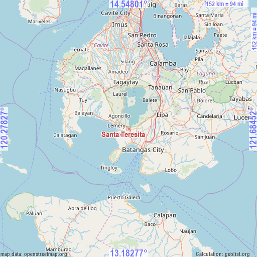
Santa Teresita GPS coordinates[2]
13° 51' 59.004" North, 120° 58' 53.004" East
| Map corner | latitude | longitude |
|---|---|---|
| Upper-left | 14.54801°, | 120.27827° |
| Center: | 13.86639°, | 120.98139° |
| Lower-right: | 13.18277°, | 121.68452° |
| Map W x H: | 151.8×151.8 km | = 94.3×94.3mi |
| max Lat: | 20.78733° ⇑33.3% North |
| Santa Teresita: | 13.86639° |
| min Lat: | ⇓66.7% South 4.65442° |
| min Long | Santa Teresita | max Long |
| 117.04868° | 120.98139° | 126.58417° |
| W 23.2%⇐ | ⇒76.8% E |
Elevation
Elevation of Santa Teresita is 176 m = 577 ft, and this is 88.1 m = 289 ft above average elevation for this country.
| Max E: |
2262 m = 7421 ft | 12.3% |
| Santa Teresita | 176 m 577 ft | |
| Avg. | 87.9 m = 288 ft | |
Min E: |
-2 m = -7 ft | 87.7% |
See also: Philippines elevation on elevation.city.
Geographical zone
Santa Teresita is located in North Torrid zone (between Equator and Tropic of Cancer). Distance of this Northern Tropic circle is 1064.1 km =661.2 mi to North.| Distance of | km | miles | from Santa Teresita |
|---|---|---|---|
| North Pole | 8465.3 | 5260.1 | to North |
| Arctic Circle | 5859.4 | 3640.9 | to North |
| Tropic Cancer | 1064.1 | 661.2 | to North |
| Equator | 1541.8 | 958 | to South |


Nearby cities:
15 places around Santa Teresita: (largest is in red/bold)
• Alitagtag
2.5 km =1.6 mi,  94°
94°
• Bauan
8.8 km =5.5 mi,  160°
160°
• Bolo
8.5 km =5.3 mi,  179°
179°
• Calumpang
2.7 km =1.7 mi,  193°
193°
• Cuenca
8.6 km =5.3 mi,  62°
62°
• Inicbulan
5.1 km =3.2 mi, 177°
• Lemery
7.5 km =4.7 mi,  282°
282°
• Mozon
1.8 km =1.1 mi,  150°
150°
• Mulauin
3.8 km =2.4 mi, 89°
• San Jose
3.8 km =2.4 mi,  245°
245°
• San Luis
7.1 km =4.4 mi,  259°
259°
• San Nicolas
7.6 km =4.7 mi,  334°
334°
• San Pascual
7.6 km =4.7 mi,  144°
144°
• Sinala
6.8 km =4.2 mi, 186°
• Taal
6.5 km =4 mi, 283°
Sources, notices
• [Note1] Compared only with cities in Philippines existing in our database
• [Src1] Map data: © OpenStreetMap contributors (CC-BY-SA)
• [Src2] Other city data from geonames.org with taken over terms of usage.
• [Src3] Geographical zone / Annual Mean Temperature by Robert A. Rohde @ Wikipedia
