Mozon geodata
Mozon (Calabarzon) is a populated place; located in Philippines in Asia/Manila (GMT+8) time zone. With population of 4,301 people, there are 1584 cities with bigger population in this country. Compared to other cities in Philippines, 66.4% of cities are located further ↓South; 76.6% of cities are located further →East and 88.5% of cities have lower elevation than Mozon. Note1


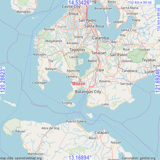
Mozon GPS coordinates[2]
13° 51' 9.36" North, 120° 59' 21.66" East
| Map corner | latitude | longitude |
|---|---|---|
| Upper-left | 14.53426°, | 120.28623° |
| Center: | 13.8526°, | 120.98935° |
| Lower-right: | 13.16894°, | 121.69248° |
| Map W x H: | 151.8×151.8 km | = 94.3×94.3mi |
| max Lat: | 20.78733° ⇑33.6% North |
| Mozon: | 13.8526° |
| min Lat: | ⇓66.4% South 4.65442° |
| min Long | Mozon | max Long |
| 117.04868° | 120.98935° | 126.58417° |
| W 23.4%⇐ | ⇒76.6% E |
Elevation
Elevation of Mozon is 191 m = 627 ft, and this is 103.1 m = 338 ft above average elevation for this country.
| Max E: |
2262 m = 7421 ft | 11.5% |
| Mozon | 191 m 627 ft | |
| Avg. | 87.9 m = 288 ft | |
Min E: |
-2 m = -7 ft | 88.5% |
See also: Philippines elevation on elevation.city.
Geographical zone
Mozon is located in North Torrid zone (between Equator and Tropic of Cancer). Distance of this Northern Tropic circle is 1065.7 km =662.2 mi to North.| Distance of | km | miles | from Mozon |
|---|---|---|---|
| North Pole | 8466.8 | 5261 | to North |
| Arctic Circle | 5860.9 | 3641.8 | to North |
| Tropic Cancer | 1065.7 | 662.2 | to North |
| Equator | 1540.3 | 957.1 | to South |


Nearby cities:
15 places around Mozon: (largest is in red/bold)
• Alitagtag
2.1 km =1.3 mi,  50°
50°
• Bauan
7.1 km =4.4 mi,  163°
163°
• Bolo
7 km =4.3 mi,  186°
186°
• Calumpang
1.9 km =1.2 mi,  232°
232°
• Cuenca
8.7 km =5.4 mi, 50°
• Inicbulan
3.6 km =2.2 mi, 190°
• Lemery
8.7 km =5.4 mi,  291°
291°
• Mulauin
3.3 km =2.1 mi,  62°
62°
• San Jose
4.3 km =2.7 mi,  269°
269°
• San Luis
7.9 km =4.9 mi, 271°
• San Nicolas
9.4 km =5.8 mi,  333°
333°
• San Pascual
5.9 km =3.7 mi,  143°
143°
• Santa Teresita
1.8 km =1.1 mi, 330°
• Sinala
5.5 km =3.4 mi,  196°
196°
• Taal
7.8 km =4.8 mi, 293°
Sources, notices
• [Note1] Compared only with cities in Philippines existing in our database
• [Src1] Map data: © OpenStreetMap contributors (CC-BY-SA)
• [Src2] Other city data from geonames.org with taken over terms of usage.
• [Src3] Geographical zone / Annual Mean Temperature by Robert A. Rohde @ Wikipedia
