San Mateo geodata
San Mateo (Cagayan Valley) is a populated place; located in Philippines in Asia/Manila (GMT+8) time zone. With population of 2,090 people, there are 4087 cities with bigger population in this country. Compared to other cities in Philippines, 94.4% of cities are located further ↓South; 63.4% of cities are located further →East and 70% of cities have lower elevation than San Mateo. Note1


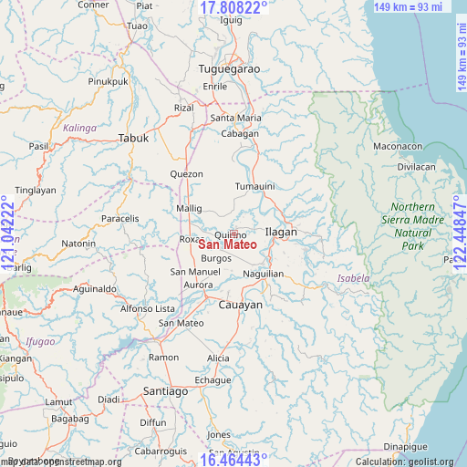
San Mateo GPS coordinates[2]
17° 8' 15.144" North, 121° 44' 43.224" East
| Map corner | latitude | longitude |
|---|---|---|
| Upper-left | 17.80822°, | 121.04222° |
| Center: | 17.13754°, | 121.74534° |
| Lower-right: | 16.46443°, | 122.44847° |
| Map W x H: | 149.4×149.4 km | = 92.8×92.8mi |
| max Lat: | 20.78733° ⇑5.6% North |
| San Mateo: | 17.13754° |
| min Lat: | ⇓94.4% South 4.65442° |
| min Long | San Mateo | max Long |
| 117.04868° | 121.74534° | 126.58417° |
| W 36.6%⇐ | ⇒63.4% E |
Elevation
Elevation of San Mateo is 52 m = 171 ft, and this is 35.9 m = 118 ft below average elevation for this country.
| Max E: |
2262 m = 7421 ft | 30% |
| Avg. | 87.9 m = 288 ft | |
| San Mateo | 52 m = 171 ft | |
Min E: |
-2 m = -7 ft | 70% |
See also: Philippines elevation on elevation.city.
Geographical zone
San Mateo is located in North Torrid zone (between Equator and Tropic of Cancer). Distance of this Northern Tropic circle is 700.4 km =435.2 mi to North.| Distance of | km | miles | from San Mateo |
|---|---|---|---|
| North Pole | 8101.5 | 5034 | to North |
| Arctic Circle | 5495.7 | 3414.9 | to North |
| Tropic Cancer | 700.4 | 435.2 | to North |
| Equator | 1905.5 | 1184 | to South |


Nearby cities:
15 places around San Mateo: (largest is in red/bold)
• Alibago
13.1 km =8.1 mi,  100°
100°
• Bacnor East
12.3 km =7.6 mi,  201°
201°
• Banquero
13.2 km =8.2 mi,  164°
164°
• Burgos
7 km =4.3 mi,  220°
220°
• Cabannungan Second
11.3 km =7 mi, 97°
• Cullalabo del Sur
5.9 km =3.7 mi,  228°
228°
• Furao
12.7 km =7.9 mi,  154°
154°
• Gamu
13.7 km =8.5 mi,  135°
135°
• Mabini
4.4 km =2.7 mi, 195°
• Muñoz East
14.2 km =8.8 mi,  279°
279°
• Quirino
4.8 km =3 mi,  264°
264°
• Roxas
13.5 km =8.4 mi, 261°
• Sandiat Centro
13.5 km =8.4 mi,  237°
237°
• Santo Domingo
2.6 km =1.6 mi,  15°
15°
• Upi
11.3 km =7 mi,  122°
122°
Sources, notices
• [Note1] Compared only with cities in Philippines existing in our database
• [Src1] Map data: © OpenStreetMap contributors (CC-BY-SA)
• [Src2] Other city data from geonames.org with taken over terms of usage.
• [Src3] Geographical zone / Annual Mean Temperature by Robert A. Rohde @ Wikipedia
