San Andres geodata
San Andres (Bicol) is a populated place; located in Philippines in Asia/Manila (GMT+8) time zone. With population of 2,250 people, there are 3787 cities with bigger population in this country. Compared to other cities in Philippines, 59.5% of cities are located further ↓South; 67.6% of cities are located further ←West and 75.8% of cities have lower elevation than San Andres. Note1
Administrative division(s):
- Level 1: Bicol
- Level 2: Province of Albay
- Level 3: Santo Domingo (Libog)


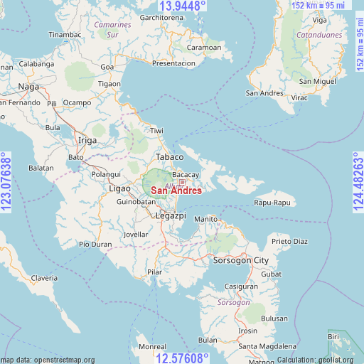
San Andres GPS coordinates[2]
13° 15' 41.04" North, 123° 46' 46.2" East
| Map corner | latitude | longitude |
|---|---|---|
| Upper-left | 13.9448°, | 123.07638° |
| Center: | 13.2614°, | 123.7795° |
| Lower-right: | 12.57608°, | 124.48263° |
| Map W x H: | 152.2×152.2 km | = 94.6×94.6mi |
| max Lat: | 20.78733° ⇑40.5% North |
| San Andres: | 13.2614° |
| min Lat: | ⇓59.5% South 4.65442° |
| min Long | San Andres | max Long |
| 117.04868° | 123.7795° | 126.58417° |
| W 67.6%⇐ | ⇒32.4% E |
Elevation
Elevation of San Andres is 71 m = 233 ft, and this is 16.9 m = 55 ft below average elevation for this country.
| Max E: |
2262 m = 7421 ft | 24.2% |
| Avg. | 87.9 m = 288 ft | |
| San Andres | 71 m = 233 ft | |
Min E: |
-2 m = -7 ft | 75.8% |
See also: Philippines elevation on elevation.city.
Geographical zone
San Andres is located in North Torrid zone (between Equator and Tropic of Cancer). Distance of this Northern Tropic circle is 1131.4 km =703 mi to North.| Distance of | km | miles | from San Andres |
|---|---|---|---|
| North Pole | 8532.5 | 5301.8 | to North |
| Arctic Circle | 5926.6 | 3682.6 | to North |
| Tropic Cancer | 1131.4 | 703 | to North |
| Equator | 1474.5 | 916.2 | to South |


Nearby cities:
15 places around San Andres: (largest is in red/bold)
• Bacacay
3.8 km =2.4 mi,  20°
20°
• Bigaa
7.3 km =4.5 mi,  199°
199°
• Binitayan
4.4 km =2.7 mi,  327°
327°
• Bonga
3 km =1.9 mi,  312°
312°
• Libog
3 km =1.9 mi,  183°
183°
• Malilipot
7.8 km =4.8 mi, 325°
• Miliroc
12.5 km =7.8 mi,  317°
317°
• Padang
4.9 km =3 mi, 198°
• Pawa
10.8 km =6.7 mi,  209°
209°
• San Francisco
6.9 km =4.3 mi, 332°
• San Roque
4.7 km =2.9 mi,  301°
301°
• San Roque
12.2 km =7.6 mi,  193°
193°
• Santo Domingo
2.9 km =1.8 mi, 184°
• Tabaco
11.9 km =7.4 mi,  335°
335°
• Tagas
12.5 km =7.8 mi, 212°
Sources, notices
• [Note1] Compared only with cities in Philippines existing in our database
• [Src1] Map data: © OpenStreetMap contributors (CC-BY-SA)
• [Src2] Other city data from geonames.org with taken over terms of usage.
• [Src3] Geographical zone / Annual Mean Temperature by Robert A. Rohde @ Wikipedia
