Padang geodata
Padang (Bicol) is a populated place; located in Philippines in Asia/Manila (GMT+8) time zone. With population of 2,187 people, there are 3914 cities with bigger population in this country. Compared to other cities in Philippines, 59% of cities are located further ↓South; 67.2% of cities are located further ←West and 54.5% of cities have higher elevation than Padang. Note1
Administrative division(s):
- Level 1: Bicol
- Level 2: Province of Albay
- Level 3: Santo Domingo (Libog)


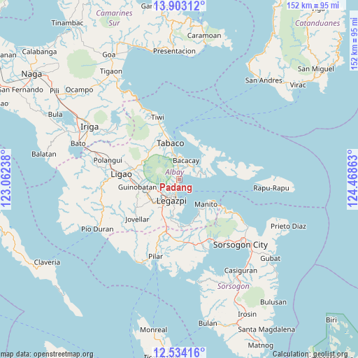
Padang GPS coordinates[2]
13° 13' 10.56" North, 123° 45' 55.8" East
| Map corner | latitude | longitude |
|---|---|---|
| Upper-left | 13.90312°, | 123.06238° |
| Center: | 13.2196°, | 123.7655° |
| Lower-right: | 12.53416°, | 124.46863° |
| Map W x H: | 152.2×152.2 km | = 94.6×94.6mi |
| max Lat: | 20.78733° ⇑41% North |
| Padang: | 13.2196° |
| min Lat: | ⇓59% South 4.65442° |
| min Long | Padang | max Long |
| 117.04868° | 123.7655° | 126.58417° |
| W 67.2%⇐ | ⇒32.8% E |
Elevation
Elevation of Padang is 20 m = 66 ft, and this is 67.9 m = 223 ft below average elevation for this country.
| Max E: |
2262 m = 7421 ft | 54.5% |
| Avg. | 87.9 m = 288 ft | |
| Padang | 20 m = 66 ft | |
Min E: |
-2 m = -7 ft | 45.5% |
See also: Philippines elevation on elevation.city.
Geographical zone
Padang is located in North Torrid zone (between Equator and Tropic of Cancer). Distance of this Northern Tropic circle is 1136 km =705.9 mi to North.| Distance of | km | miles | from Padang |
|---|---|---|---|
| North Pole | 8537.2 | 5304.8 | to North |
| Arctic Circle | 5931.3 | 3685.5 | to North |
| Tropic Cancer | 1136 | 705.9 | to North |
| Equator | 1469.9 | 913.4 | to South |


Nearby cities:
15 places around Padang: (largest is in red/bold)
• Anuling
9.7 km =6 mi,  263°
263°
• Bacacay
8.7 km =5.4 mi,  19°
19°
• Bigaa
2.5 km =1.6 mi,  203°
203°
• Binitayan
8.4 km =5.2 mi,  354°
354°
• Bonga
6.7 km =4.2 mi, 353°
• Daraga
9.8 km =6.1 mi,  215°
215°
• Legaspi
9.1 km =5.7 mi, 197°
• Libog
2.2 km =1.4 mi,  38°
38°
• Pawa
6.1 km =3.8 mi, 219°
• Sagpon
8.5 km =5.3 mi, 204°
• San Andres
4.9 km =3 mi, 18°
• San Roque
7.3 km =4.5 mi,  189°
189°
• San Roque
7.6 km =4.7 mi,  340°
340°
• Santo Domingo
2.2 km =1.4 mi, 36°
• Tagas
7.9 km =4.9 mi, 221°
Sources, notices
• [Note1] Compared only with cities in Philippines existing in our database
• [Src1] Map data: © OpenStreetMap contributors (CC-BY-SA)
• [Src2] Other city data from geonames.org with taken over terms of usage.
• [Src3] Geographical zone / Annual Mean Temperature by Robert A. Rohde @ Wikipedia
