Rio Tuba geodata
Rio Tuba (Mimaropa) is a populated place; located in Philippines in Asia/Manila (GMT+8) time zone. With population of 8,944 people, there are 693 cities with bigger population in this country. Compared to other cities in Philippines, 78.7% of cities are located further ↑North; 99.9% of cities are located further →East and 89.7% of cities have higher elevation than Rio Tuba. Note1


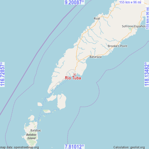
Rio Tuba GPS coordinates[2]
8° 30' 22.068" North, 117° 25' 54.084" East
| Map corner | latitude | longitude |
|---|---|---|
| Upper-left | 9.20087°, | 116.72857° |
| Center: | 8.50613°, | 117.43169° |
| Lower-right: | 7.81012°, | 118.13482° |
| Map W x H: | 154.6×154.6 km | = 96.1×96.1mi |
| max Lat: | 20.78733° ⇑78.7% North |
| Rio Tuba: | 8.50613° |
| min Lat: | ⇓21.3% South 4.65442° |
| min Long | Rio Tuba | max Long |
| 117.04868° | 117.43169° | 126.58417° |
| W 0.1%⇐ | ⇒99.9% E |
Elevation
Elevation of Rio Tuba is 7 m = 23 ft, and this is 80.9 m = 265 ft below average elevation for this country.
| Max E: |
2262 m = 7421 ft | 89.7% |
| Avg. | 87.9 m = 288 ft | |
| Rio Tuba | 7 m = 23 ft | |
Min E: |
-2 m = -7 ft | 10.3% |
See also: Philippines elevation on elevation.city.
Geographical zone
Rio Tuba is located in North Torrid zone (between Equator and Tropic of Cancer). Distance of Equator is 945.8 km =587.7 mi to South.| Distance of | km | miles | from Rio Tuba |
|---|---|---|---|
| North Pole | 9061.3 | 5630.4 | to North |
| Arctic Circle | 6455.4 | 4011.2 | to North |
| Tropic Cancer | 1660.1 | 1031.5 | to North |
| Equator | 945.8 | 587.7 | to South |


Nearby cities:
15 places around Rio Tuba: (largest is in red/bold)
• Balabac
71.8 km =44.6 mi,  215°
215°
• Barong Barong
63.8 km =39.6 mi,  52°
52°
• Batarasa
28.5 km =17.7 mi, 49°
• Bunog
80.3 km =49.9 mi,  28°
28°
• Conduaga
40.1 km =24.9 mi,  9°
9°
• Eraan
68.6 km =42.6 mi, 25°
• Ipilan
64 km =39.8 mi, 54°
• Iraray
87 km =54.1 mi, 51°
• Mainit
56.7 km =35.2 mi, 48°
• Panalingaan
30.9 km =19.2 mi,  358°
358°
• Pañgobilian
57.3 km =35.6 mi,  55°
55°
• Ransang
53.2 km =33.1 mi,  18°
18°
• Saraza
46 km =28.6 mi, 56°
• Tagbita
24.7 km =15.3 mi,  338°
338°
• Tarusan
18.6 km =11.6 mi, 27°
Sources, notices
• [Note1] Compared only with cities in Philippines existing in our database
• [Src1] Map data: © OpenStreetMap contributors (CC-BY-SA)
• [Src2] Other city data from geonames.org with taken over terms of usage.
• [Src3] Geographical zone / Annual Mean Temperature by Robert A. Rohde @ Wikipedia
