Tagbita geodata
Tagbita (Mimaropa) is a populated place; located in Philippines in Asia/Manila (GMT+8) time zone. With population of 2,501 people, there are 3283 cities with bigger population in this country. Compared to other cities in Philippines, 77.2% of cities are located further ↑North; 100% of cities are located further →East and 92.7% of cities have higher elevation than Tagbita. Note1


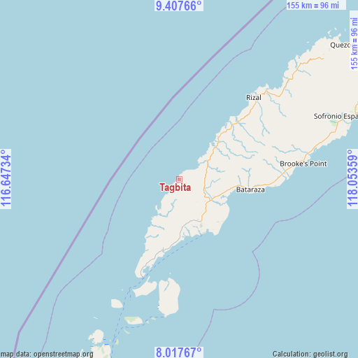
Tagbita GPS coordinates[2]
8° 42' 47.916" North, 117° 21' 1.656" East
| Map corner | latitude | longitude |
|---|---|---|
| Upper-left | 9.40766°, | 116.64734° |
| Center: | 8.71331°, | 117.35046° |
| Lower-right: | 8.01767°, | 118.05359° |
| Map W x H: | 154.6×154.6 km | = 96.1×96.1mi |
| max Lat: | 20.78733° ⇑77.2% North |
| Tagbita: | 8.71331° |
| min Lat: | ⇓22.8% South 4.65442° |
| min Long | Tagbita | max Long |
| 117.04868° | 117.35046° | 126.58417° |
| W 0%⇐ | ⇒100% E |
Elevation
Elevation of Tagbita is 6 m = 20 ft, and this is 81.9 m = 269 ft below average elevation for this country.
| Max E: |
2262 m = 7421 ft | 92.7% |
| Avg. | 87.9 m = 288 ft | |
| Tagbita | 6 m = 20 ft | |
Min E: |
-2 m = -7 ft | 7.3% |
See also: Philippines elevation on elevation.city.
Geographical zone
Tagbita is located in North Torrid zone (between Equator and Tropic of Cancer). Distance of Equator is 968.8 km =602 mi to South.| Distance of | km | miles | from Tagbita |
|---|---|---|---|
| North Pole | 9038.2 | 5616.1 | to North |
| Arctic Circle | 6432.3 | 3996.8 | to North |
| Tropic Cancer | 1637.1 | 1017.2 | to North |
| Equator | 968.8 | 602 | to South |


Nearby cities:
15 places around Tagbita: (largest is in red/bold)
• Barong Barong
61.7 km =38.3 mi,  75°
75°
• Batarasa
30.8 km =19.1 mi,  98°
98°
• Bunog
67.1 km =41.7 mi,  44°
44°
• Conduaga
22.5 km =14 mi, 42°
• Eraan
54.8 km =34.1 mi, 44°
• Ipilan
62.4 km =38.8 mi, 76°
• Iraray
83 km =51.6 mi,  67°
67°
• Mainit
53.4 km =33.2 mi, 74°
• Panalingaan
11.2 km =7 mi,  45°
45°
• Pañgobilian
56.8 km =35.3 mi, 80°
• Ransang
37.5 km =23.3 mi, 42°
• Rio Tuba
24.7 km =15.3 mi,  158°
158°
• Saraza
47.3 km =29.4 mi,  87°
87°
• Tagusao
73.7 km =45.8 mi, 43°
• Tarusan
18.8 km =11.7 mi,  110°
110°
Sources, notices
• [Note1] Compared only with cities in Philippines existing in our database
• [Src1] Map data: © OpenStreetMap contributors (CC-BY-SA)
• [Src2] Other city data from geonames.org with taken over terms of usage.
• [Src3] Geographical zone / Annual Mean Temperature by Robert A. Rohde @ Wikipedia
