Ransang geodata
Ransang (Mimaropa) is a populated place; located in Philippines in Asia/Manila (GMT+8) time zone. With population of 3,548 people, there are 2020 cities with bigger population in this country. Compared to other cities in Philippines, 76.2% of cities are located further ↑North; 99.9% of cities are located further →East and 89.7% of cities have higher elevation than Ransang. Note1


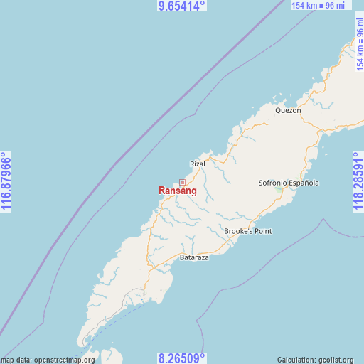
Ransang GPS coordinates[2]
8° 57' 37.008" North, 117° 34' 58.008" East
| Map corner | latitude | longitude |
|---|---|---|
| Upper-left | 9.65414°, | 116.87966° |
| Center: | 8.96028°, | 117.58278° |
| Lower-right: | 8.26509°, | 118.28591° |
| Map W x H: | 154.4×154.5 km | = 95.9×96mi |
| max Lat: | 20.78733° ⇑76.2% North |
| Ransang: | 8.96028° |
| min Lat: | ⇓23.8% South 4.65442° |
| min Long | Ransang | max Long |
| 117.04868° | 117.58278° | 126.58417° |
| W 0.1%⇐ | ⇒99.9% E |
Elevation
Elevation of Ransang is 7 m = 23 ft, and this is 80.9 m = 265 ft below average elevation for this country.
| Max E: |
2262 m = 7421 ft | 89.7% |
| Avg. | 87.9 m = 288 ft | |
| Ransang | 7 m = 23 ft | |
Min E: |
-2 m = -7 ft | 10.3% |
See also: Philippines elevation on elevation.city.
Geographical zone
Ransang is located in North Torrid zone (between Equator and Tropic of Cancer). Distance of Equator is 996.3 km =619.1 mi to South.| Distance of | km | miles | from Ransang |
|---|---|---|---|
| North Pole | 9010.8 | 5599 | to North |
| Arctic Circle | 6404.9 | 3979.8 | to North |
| Tropic Cancer | 1609.6 | 1000.2 | to North |
| Equator | 996.3 | 619.1 | to South |


Nearby cities:
15 places around Ransang: (largest is in red/bold)
• Barong Barong
36.2 km =22.5 mi,  109°
109°
• Batarasa
32.3 km =20.1 mi,  171°
171°
• Bunog
29.6 km =18.4 mi,  47°
47°
• Conduaga
15 km =9.3 mi,  223°
223°
• Eraan
17.3 km =10.7 mi, 48°
• Ipilan
37.5 km =23.3 mi, 110°
• Iraray
51.6 km =32.1 mi,  85°
85°
• Mainit
28.9 km =18 mi,  116°
116°
• Panalingaan
26.3 km =16.3 mi, 221°
• Pañgobilian
35.2 km =21.9 mi, 120°
• Punang
51.6 km =32.1 mi,  82°
82°
• Saraza
33.1 km =20.6 mi,  139°
139°
• Tagbita
37.5 km =23.3 mi, 222°
• Tagusao
36.2 km =22.5 mi,  44°
44°
• Tarusan
34.9 km =21.7 mi,  193°
193°
Sources, notices
• [Note1] Compared only with cities in Philippines existing in our database
• [Src1] Map data: © OpenStreetMap contributors (CC-BY-SA)
• [Src2] Other city data from geonames.org with taken over terms of usage.
• [Src3] Geographical zone / Annual Mean Temperature by Robert A. Rohde @ Wikipedia
