Batarasa geodata
Batarasa (Mimaropa) is a populated place; located in Philippines in Asia/Manila (GMT+8) time zone. With population of 6,169 people, there are 1013 cities with bigger population in this country. Compared to other cities in Philippines, 77.3% of cities are located further ↑North; 99.8% of cities are located further →East and 65.1% of cities have higher elevation than Batarasa. Note1


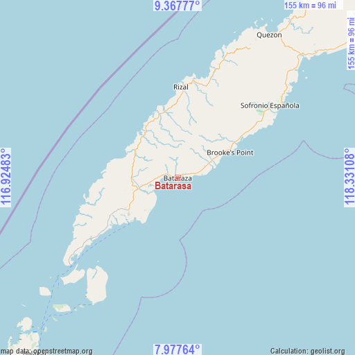
Batarasa GPS coordinates[2]
8° 40' 24.06" North, 117° 37' 40.62" East
| Map corner | latitude | longitude |
|---|---|---|
| Upper-left | 9.36777°, | 116.92483° |
| Center: | 8.67335°, | 117.62795° |
| Lower-right: | 7.97764°, | 118.33108° |
| Map W x H: | 154.6×154.6 km | = 96.1×96.1mi |
| max Lat: | 20.78733° ⇑77.3% North |
| Batarasa: | 8.67335° |
| min Lat: | ⇓22.7% South 4.65442° |
| min Long | Batarasa | max Long |
| 117.04868° | 117.62795° | 126.58417° |
| W 0.2%⇐ | ⇒99.8% E |
Elevation
Elevation of Batarasa is 14 m = 46 ft, and this is 73.9 m = 242 ft below average elevation for this country.
| Max E: |
2262 m = 7421 ft | 65.1% |
| Avg. | 87.9 m = 288 ft | |
| Batarasa | 14 m = 46 ft | |
Min E: |
-2 m = -7 ft | 34.9% |
See also: Philippines elevation on elevation.city.
Geographical zone
Batarasa is located in North Torrid zone (between Equator and Tropic of Cancer). Distance of Equator is 964.4 km =599.3 mi to South.| Distance of | km | miles | from Batarasa |
|---|---|---|---|
| North Pole | 9042.7 | 5618.9 | to North |
| Arctic Circle | 6436.8 | 3999.6 | to North |
| Tropic Cancer | 1641.5 | 1020 | to North |
| Equator | 964.4 | 599.3 | to South |


Nearby cities:
15 places around Batarasa: (largest is in red/bold)
• Barong Barong
35.4 km =22 mi,  55°
55°
• Bunog
54.6 km =33.9 mi,  18°
18°
• Conduaga
25.9 km =16.1 mi,  324°
324°
• Eraan
44.1 km =27.4 mi,  10°
10°
• Ipilan
35.7 km =22.2 mi, 58°
• Iraray
58.6 km =36.4 mi,  52°
52°
• Mainit
28.2 km =17.5 mi, 47°
• Panalingaan
25.7 km =16 mi,  298°
298°
• Pañgobilian
29.1 km =18.1 mi, 60°
• Punang
60 km =37.3 mi, 50°
• Ransang
32.3 km =20.1 mi,  351°
351°
• Rio Tuba
28.5 km =17.7 mi,  229°
229°
• Saraza
18.1 km =11.2 mi,  67°
67°
• Tagbita
30.8 km =19.1 mi,  278°
278°
• Tarusan
13.1 km =8.1 mi,  260°
260°
Sources, notices
• [Note1] Compared only with cities in Philippines existing in our database
• [Src1] Map data: © OpenStreetMap contributors (CC-BY-SA)
• [Src2] Other city data from geonames.org with taken over terms of usage.
• [Src3] Geographical zone / Annual Mean Temperature by Robert A. Rohde @ Wikipedia
