Sankanan geodata
Sankanan (Northern Mindanao) is a populated place; located in Philippines in Asia/Manila (GMT+8) time zone. With population of 3,055 people, there are 2466 cities with bigger population in this country. Compared to other cities in Philippines, 79.9% of cities are located further ↑North; 85.5% of cities are located further ←West and 97.4% of cities have lower elevation than Sankanan. Note1
Administrative division(s):
- Level 1: Northern Mindanao
- Level 2: Province of Bukidnon
- Level 3: Manolo Fortich


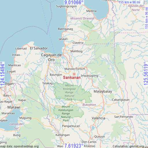
Sankanan GPS coordinates[2]
8° 18' 56.016" North, 124° 51' 29.016" East
| Map corner | latitude | longitude |
|---|---|---|
| Upper-left | 9.01066°, | 124.15494° |
| Center: | 8.31556°, | 124.85806° |
| Lower-right: | 7.61923°, | 125.56119° |
| Map W x H: | 154.7×154.7 km | = 96.1×96.1mi |
| max Lat: | 20.78733° ⇑79.9% North |
| Sankanan: | 8.31556° |
| min Lat: | ⇓20.1% South 4.65442° |
| min Long | Sankanan | max Long |
| 117.04868° | 124.85806° | 126.58417° |
| W 85.5%⇐ | ⇒14.5% E |
Elevation
Elevation of Sankanan is 686 m = 2251 ft, and this is 598.1 m = 1962 ft above average elevation for this country.
| Max E: |
2262 m = 7421 ft | 2.6% |
| Sankanan | 686 m 2251 ft | |
| Avg. | 87.9 m = 288 ft | |
Min E: |
-2 m = -7 ft | 97.4% |
See also: Philippines elevation on elevation.city.
Geographical zone
Sankanan is located in North Torrid zone (between Equator and Tropic of Cancer). Distance of Equator is 924.6 km =574.5 mi to South.| Distance of | km | miles | from Sankanan |
|---|---|---|---|
| North Pole | 9082.5 | 5643.6 | to North |
| Arctic Circle | 6476.6 | 4024.4 | to North |
| Tropic Cancer | 1681.3 | 1044.7 | to North |
| Equator | 924.6 | 574.5 | to South |


Nearby cities:
15 places around Sankanan: (largest is in red/bold)
• Alae
13.1 km =8.1 mi,  337°
337°
• Dalirig
8.4 km =5.2 mi,  34°
34°
• Damilag
6.7 km =4.2 mi,  310°
310°
• Kalugmanan
4.2 km =2.6 mi,  177°
177°
• Kisolon
13.2 km =8.2 mi,  83°
83°
• La Fortuna
16.3 km =10.1 mi,  104°
104°
• Libona
13.8 km =8.6 mi,  280°
280°
• Maluko
12.4 km =7.7 mi,  57°
57°
• Mambatangan
13.4 km =8.3 mi,  348°
348°
• Manolo Fortich
6.1 km =3.8 mi,  6°
6°
• Pongol
12.8 km =8 mi,  251°
251°
• Pontian
6 km =3.7 mi,  129°
129°
• Salimbalan
15.7 km =9.8 mi, 252°
• Santa Fe
9 km =5.6 mi,  289°
289°
• Sumilao
10.1 km =6.3 mi,  108°
108°
Sources, notices
• [Note1] Compared only with cities in Philippines existing in our database
• [Src1] Map data: © OpenStreetMap contributors (CC-BY-SA)
• [Src2] Other city data from geonames.org with taken over terms of usage.
• [Src3] Geographical zone / Annual Mean Temperature by Robert A. Rohde @ Wikipedia
