Polañge geodata
Polañge (Eastern Visayas) is a populated place; located in Philippines in Asia/Manila (GMT+8) time zone. With population of 2,647 people, there are 3031 cities with bigger population in this country. Compared to other cities in Philippines, 54% of cities are located further ↓South; 81.4% of cities are located further ←West and 80.7% of cities have higher elevation than Polañge. Note1
Administrative division(s):
- Level 1: Eastern Visayas
- Level 2: Province of Northern Samar
- Level 3: Catarman


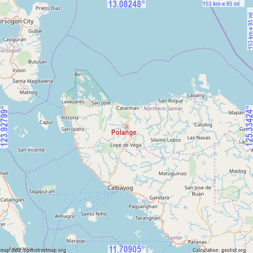
Polañge GPS coordinates[2]
12° 23' 48.012" North, 124° 37' 51.996" East
| Map corner | latitude | longitude |
|---|---|---|
| Upper-left | 13.08248°, | 123.92799° |
| Center: | 12.39667°, | 124.63111° |
| Lower-right: | 11.70905°, | 125.33424° |
| Map W x H: | 152.7×152.7 km | = 94.9×94.9mi |
| max Lat: | 20.78733° ⇑46% North |
| Polañge: | 12.39667° |
| min Lat: | ⇓54% South 4.65442° |
| min Long | Polañge | max Long |
| 117.04868° | 124.63111° | 126.58417° |
| W 81.4%⇐ | ⇒18.6% E |
Elevation
Elevation of Polañge is 9 m = 30 ft, and this is 78.9 m = 259 ft below average elevation for this country.
| Max E: |
2262 m = 7421 ft | 80.7% |
| Avg. | 87.9 m = 288 ft | |
| Polañge | 9 m = 30 ft | |
Min E: |
-2 m = -7 ft | 19.3% |
See also: Philippines elevation on elevation.city.
Geographical zone
Polañge is located in North Torrid zone (between Equator and Tropic of Cancer). Distance of this Northern Tropic circle is 1227.5 km =762.7 mi to North.| Distance of | km | miles | from Polañge |
|---|---|---|---|
| North Pole | 8628.7 | 5361.6 | to North |
| Arctic Circle | 6022.8 | 3742.4 | to North |
| Tropic Cancer | 1227.5 | 762.7 | to North |
| Equator | 1378.4 | 856.5 | to South |


Nearby cities:
15 places around Polañge: (largest is in red/bold)
• Bantayan
25.6 km =15.9 mi,  56°
56°
• Bobon
16 km =9.9 mi,  332°
332°
• Bugko
23.3 km =14.5 mi,  48°
48°
• Catarman
11.4 km =7.1 mi,  3°
3°
• Cervantes
4.4 km =2.7 mi,  135°
135°
• Lope de Vega
11 km =6.8 mi,  184°
184°
• Makiwalo
15 km =9.3 mi,  32°
32°
• Mondragon
18.7 km =11.6 mi,  44°
44°
• Nenita
21.6 km =13.4 mi, 60°
• Palanit
32.4 km =20.1 mi,  254°
254°
• Rosario
26.4 km =16.4 mi,  301°
301°
• San Jose
21.5 km =13.4 mi,  313°
313°
• San Roque
29.7 km =18.5 mi, 59°
• Silvino Lobos
24.5 km =15.2 mi,  116°
116°
• Viriato
32.4 km =20.1 mi, 248°
Sources, notices
• [Note1] Compared only with cities in Philippines existing in our database
• [Src1] Map data: © OpenStreetMap contributors (CC-BY-SA)
• [Src2] Other city data from geonames.org with taken over terms of usage.
• [Src3] Geographical zone / Annual Mean Temperature by Robert A. Rohde @ Wikipedia
